5.0 PROPOSED POLICY AMENDMENTS 5.0. Proposed Policy Amendments
|
|
|
- Madlyn Burns
- 5 years ago
- Views:
Transcription
1
2 5.0 PROPOSED POLICY AMENDMENTS 5.0 Proposed Policy Amendments 51
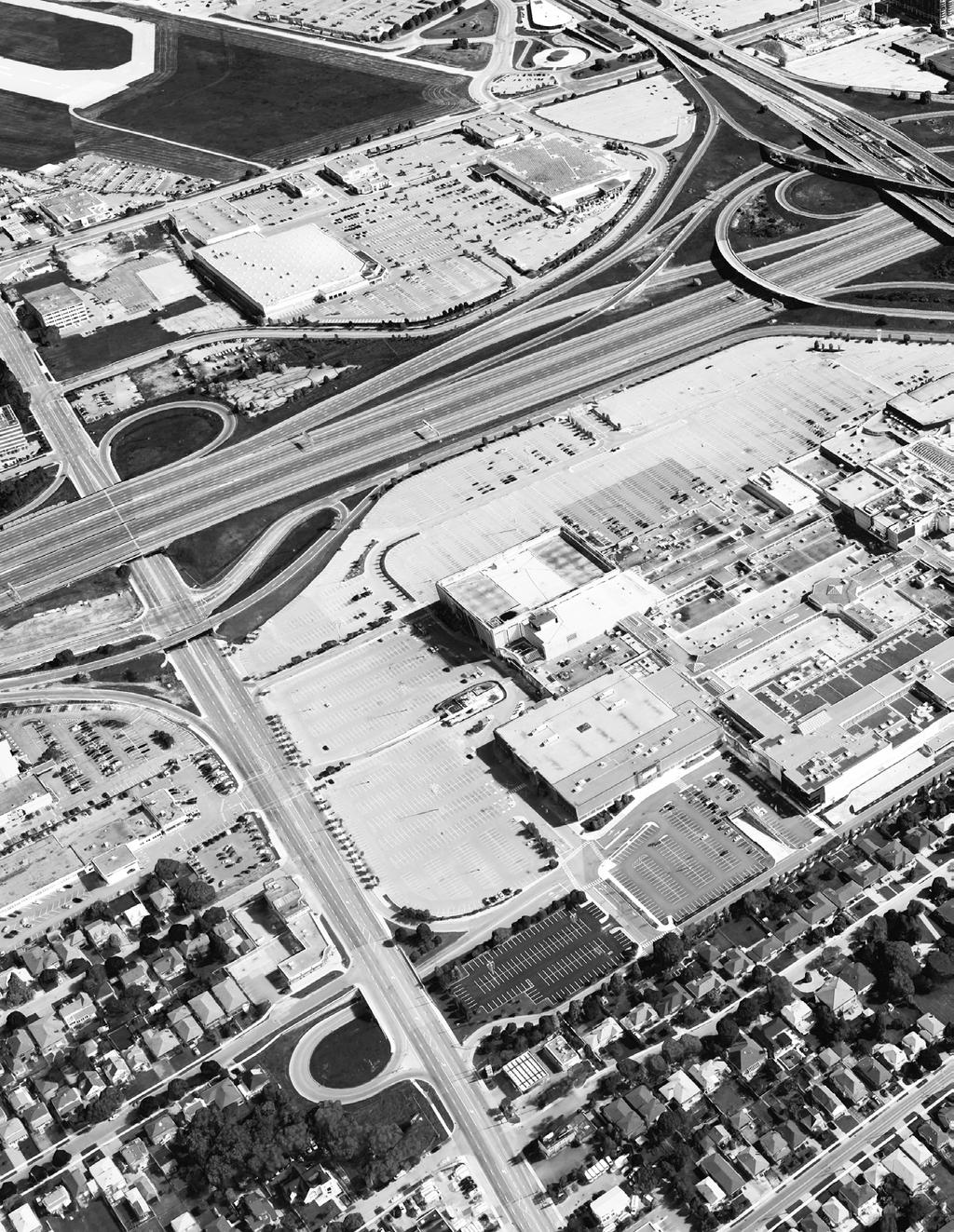
3 YORKDALE SHOPPING CENTRE PLANNING RATIONALE The following section outlines and annotates the amendment to the DSSP and North York Zoning By-law 7625, thereby implementing the master plan options into coherent planning policies. 5.1 PROPOSED AMENDMENT TO THE DSSP The DSSP provides a policy framework for the Dufferin Street corridor, but only includes a portion of the Site along Dufferin Street. As a result, the Secondary Plan includes less than a third of the Site, and fails to recognize the pivotal role the existing enclosed shopping centre plays within the area as the largest commercial and mixed use area and as a gateway to the avenue at its intersection with Highway 401. In order to successfully support and manage growth along Dufferin Street, Yorkdale proposes to amend the DSSP to include the entirety of the Site within the Secondary Plan boundary and provide a comprehensive long term plan. Yorkdale is at an important point in its evolution as a regional and city-wide retail presence. As a destination shopping centre, Yorkdale continues to attract visitors from near and far, contributing significantly to Toronto s economic growth, and alleviating pressure from downtown retail districts. While Yorkdale is frequently envisioned as an uptown Toronto shopping centre, its proximity to two other urban growth centres, major transportation corridors, and high speed transit, positions the enclosed shopping centre as a viable alternative for residents across the city. This is demonstrated by the market's decision to locate so many flagship and firstin-canada retail locations. Yorkdale s appeal is growing, and its popularity requires a flexible development framework to strengthen its role as a distinct retail destination, while creating a high quality public realm and ensuring multi-modal access to and from the Site. The continued success of Yorkdale has fueled expansion, demonstrated by the recent Nordstrom addition. The importance of Yorkdale s location, north of downtown Toronto along Highway 401 and connected to Yorkdale subway station is an essential ingredient to the Site s success, and future expansion is likely. Yorkdale anticipates expanding uses that currently exist today, such as retail and office, as well as adding those beyond what exist today, such as residential and hotel. By combining these uses, Yorkdale aims to meet provincial policies that recognize major transit station areas as a key focus for mixed-use development to accommodate intensification. A holistic DSSP will provide a development framework to accommodate the unique contexts that exist along the Dufferin Street corridor, including Yorkdale. The proposed amendment to the DSSP will build on the key principles and directions outlined in the underlying plan and the amendment and accompanying urban design guidelines proposed therein. 52
4 AS T R AL S T R E E T G R OT ON S T R E E T 5.0 PROPOSED POLICY AMENDMENTS HIGHWAY 401 YORKDALE ROAD BRIDGELAND AVENUE JANE OSLER BOULEVARD CARTWRIGHT AVENUE McADAM AVENUE GLEN BELLE CRESCENT ALCESTER STREET BENTWORTH AVENUE RANEE AVENUE SPARROW AVENUE ORFUS ROAD FLEMINGTON ROAD Structure Plan SAMOR ROAD DUFFERIN STREET KRIEGER CRESCENT CRESTON ROAD CELT AVENUE STOCKTON ROAD ALLEN ROAD Secondary Plan Area Boundary Blocks South of Lawrence Possible Building Edge New Public Streets New Public Streets: Conceptual Public Park Priv Truc Exis POP Priv APEX ROAD MULHOLLAND AVENUE DANE AVENUE CONLAND AVENUE BENALTO ROAD HIGHLAND HILL Structure Structure Plan Plan Urban Plazas Dufferin Gateway Dufferin Promenade Inte Entr Dev GOOD SHEPHERD COURT CORK AVENUE LAWRENCE AVENUE WEST BLOSSUMFIELD DRIVE Secondary Secondary Plan Plan Area Area Boundary Boundary Blocks Blocks South South of Lawrence of Lawrence Possible Possible Building Building Edge Edge New New Public Public Streets Streets New New Public Public Streets: Streets: Conceptual Conceptual Public Public Park Park Urban Urban Plazas Plazas Dufferin Dufferin Gateway Gateway Dufferin Dufferin Promenade Promenade Note: The Private public Private Road streets Road identified on this map are conceptual. The exact number and location of these streets will be determined at Truck Truck Tunnel Tunnel Existing Existing Mall Mall POPS POPS Private Private Road Road or Pedestrian or Pedestrian Connection Connection Internal Internal Circulation Circulation Entrance Entrance Feature Feature Development Development Block Block FIGURE 17. Proposed Structure Plan Note: Note: The public The public streets streets identified identified on this on map this map are conceptual. are conceptual. The exact The exact number number and location and location of these of these streets streets will be will determined be determined at the at Block the Block Master Master Plan Plan stage. stage. 53
5 YORKDALE SHOPPING CENTRE PLANNING RATIONALE Amendment to the DSSP The numbering used below is consistent with the DSSP, and policies not mentioned remain unchanged. 1.0 Vision The DSSP only included a portion of the Site within its boundaries; thus, this amendment proposes to include the entirety of the Site within the DSSP. The Site and the shopping centre are of distinct importance both for Dufferin Street and within the city and thus require recognition within the DSSP. This Plan will be amended to include the entirety of the Yorkdale lands, and all schedules are to be amended accordingly. All planning for Yorkdale should take the entirety of the Yorkdale lands into consideration, in order to holistically understand, recognize and regulate Yorkdale s distinct role in the Dufferin Street Secondary Plan. To reflect this significance, the proposed amendment to Section 1 is as follows: 1.4 Yorkdale plays an important role on Dufferin Street and within City of Toronto and it is intended to increase this role over the coming years: a. Yorkdale is an important parcel of retail on Dufferin Street, where it acts as a northern anchor for the street, drawing pedestrians and economic energy. Yorkdale will continue evolving into a major mixed use centre, which is linked to the future and the success of Dufferin Street. b. Yorkdale is an important economic driver for the city of Toronto as well as the broader region, significantly contributing to the City's tax base. c. Yorkdale is a major tourism destination for the city of Toronto and the surrounding region, fueling economic growth. d. Yorkdale is a large scale employer, providing an increasing number of long and short term jobs as the Yorkdale Lands continues to expand and evolve. (new policy) 2.0 Realizing the Vision The Vision for Yorkdale is specific to Yorkdale s position within the DSSP. It requires the addition of specific policies to the DSSP to create the appropriate environment to ensure that Yorkdale will be able to thrive and engage with Dufferin Street as a component of that avenue. 2.9 Integrating Yorkdale Shopping Centre The key planning approach for the Yorkdale lands will be to accommodate the flexibility for change and growth of the retail facilities. a. The Zoning By-law shall permit such flexibility, with the site plan process guided by Urban Design guidelines, being the most important mechanism to control built form and growth. b. Development at Yorkdale will continue to progress incrementally, with a phasing strategy that is flexible and ensures infrastructure is available/provided to support development, allowing for changing needs and evolving retail patterns. c. Urban Design Guidelines for Yorkdale will allow for this flexibility, while still ensuring a high quality successful public realm that will remain privately owned. d. At-grade retail and entertainment uses are permitted for the majority of the Yorkdale Lands, including the Dufferin Street frontage from the southern property boundary north to Point C (truck tunnel entrance) to further contribute to the retail spine on Dufferin Street. 54
6 5.0 PROPOSED POLICY AMENDMENTS e. Yorkdale will expand its mixed-use character to include a sizable component of office and residential facilities alongside its retail facilities, reflective of the intent of the Dufferin Street Secondary Plan (new policy) 3.0 Development, Land Use & Built Form Section 3 of the DSSP includes most of the physical policies and regulations for the Secondary Plan area. The policies that are in conflict with the proposed Block Master Plan for the Site include those that require subdivision and public streets, breaking the Site up to separate the existing enclosed shopping centre from Dufferin. Accordingly, it is proposed to add the following: All streets within the Yorkdale Lands will remain private but will be subject to their own guidelines which are compatible with those for the public streets. Public access, where required, will be provided through various legal mechanisms. This will ensure that growth at Yorkdale can remain flexible to accommodate changing retail and office patterns for the long term. (new policy) Yorkdale was created with and continues to expand around large format anchor stores framing the enclosed shopping centre. Most recently this included Nordstrom, which opened in October 2016 and additional stores of this scale are contemplated in the future. Disallowing large format retail uses on the Site would ignore the history and continued success of Yorkdale to the present. However, the proposed master plan also adds a balance of uses to the Site, including a variety of retail formats, office, hotel and residential, connected through the expansion of both internal and external pedestrian connections and shaped by the Urban Design Guidelines New auto-oriented and large format retail uses, and drive-through establishments, are not permitted in the Secondary Plan Area, with the exception of the Yorkdale lands (Block 14) where large-format retail stores but not drive-throughs will be permitted. (amended policy) Limiting development on the Yorkdale lands to low-rise development is based on historic information regarding flight path regulations. Height regulations for the Site should be updated to reflect current flight path information that permits mid-rise and tall buildings where they can safely be accommodated. The height for the Site is based on historic height requirements for Downsview airport, and therefore places undo restrictions on the entirety of the Yorkdale lands. The proposed heights of 25-30m within this regulated area comply with these flight path restrictions. Therefore, the development density of the Site is not limited by height restrictions imposed as a result of the Downsview airport restrictions Mid-rise buildings are appropriate for the entire Secondary Plan Area, with the exception of Low-Rise Areas in Map 36-10, where appropriate. (amended policy) All new buildings within the Secondary Plan Area will be subject to the angular plane performance standards of the Dufferin Street Urban Design Guidelines. These planes will apply to both mid-rise buildings, bases of tall buildings, and will establish the height and location of tall buildings. This policy will not apply to the private streets within Yorkdale. (amended policy) 55
7 YORKDALE SHOPPING CENTRE PLANNING RATIONALE 5.0 Density The primary limitation on density within the DSSP derives from transportation capacity. As a result of analysis completed after the Dufferin Street Transportation Master Plan, it is apparent that there is sufficient transportation capacity available to permit development at Yorkdale within the limits prescribed in Policy 5.3 below. Prior to any additional development at Yorkdale it will be necessary to prepare a Site Plan Application that includes a Transportation Impact Study to confirm that the transportation network can support the proposed development The Yorkdale Lands will be subject to Map 36-11, which is subject to a total of 2.5 FSI, comprised of a maximum of 1.25 FSI of retail (including entertainment and food and beverage), 0.8 FSI of office, 0.1 FSI of hotel, and 0.7 FSI of residential uses. (new policy) 7.0 Mobility As with the ISMMP discussed in Section 6.0, an understanding of Yorkdale s future transportation capacity and development potential was not undertaken as part of the Dufferin Street Transportation Master Plan (TMP). The outcomes of the Transportation Master Plan and resulting policies must be revisited in light of the analysis done for Yorkdale Additional density will be planned for and permitted in accordance with the policies for Block 14 (the Yorkdale property) in Section 9.5 of this plan. Servicing will be provided to accommodate for this future anticipated growth. (new policy) 6.0 Municipal Servicing As with the transportation infrastructure requirements discussed in Section 7.0 of the DSSP, the City did not anticipate any future development for the Site when calculating municipal servicing needs in the Dufferin Street Infrastructure and Stormwater Management Master Plan (ISMMP), including the development proposed in the DSSP. Therefore, the outcomes of the Infrastructure Master Plan and resulting policies are required to be revisited in light of the information to this effect. This has now been completed for Yorkdale. 6.4 Additional density will be planned for and permitted in accordance with the policies for Block 14 (the Yorkdale property) in Section 9.5 of this plan. Servicing will be provided to accommodate for this future anticipated growth. (new policy) 56
8 5.0 PROPOSED POLICY AMENDMENTS 9.0 Large Block Policies - Block 14 This section of the DSSP contains the policies and regulations that apply specifically to the Yorkdale lands. As many of the approved DSSP policies do not fully align with the Master Plan for the Site, the following new policies will guide development on the Yorkdale lands and replace all existing policies for Block 14 in section 9.0. identified as Block 14 in the DSSP, and apply in the event of conflict with the more general plans in other portions of the Secondary Plan. Primarily, the policies outlined below represent the overarching purpose of the Block 14 Master Plan: The entirety of the Yorkdale Lands will continue to be designated mixed use with retail, entertainment, residential, hotel, and office uses being supported and encouraged on-site The build out of Yorkdale (Block 14) is expected to occur over a 25-year timeframe to 2041, but may take longer dependent on market demand and ongoing management decisions. Public Realm Pedestrian circulation will occur primarily within and around Yorkdale Shopping Centre, given the generous internal weather protected pedestrian environment that exists today. As development continues, these internal connections will be integrated with extensions of the shopping centre or streets on-site to key pedestrian destinations and connections off-site. Private streets will be treated in the same way as new public streets proposed in the DSSP. Public realm treatments will be high-quality, matching or surpassing the guidelines set out by the DSSP and accompanying Urban Design Guidelines. The specifics are detailed in the Yorkdale Lands Urban Design Guidelines attached to this report. Specific policies are outlined below: Public realm will be of high quality in keeping with the Yorkdale Lands' role as a regional destination. External on-site pedestrian and vehicular connections will be private in ownership, but will follow similar guidelines as the public streets proposed in the DSSP Urban Design Guidelines Street greening and public realm treatment will mimic those in the Dufferin Street Secondary Plan while allowing for place-making nuances and treatments Pedestrian circulation will function largely within and through the interior of the Yorkdale Lands, extending seamlessly to private roads and connections. Dufferin Street Frontage Because the DSSP did not take the entirety of the Yorkdale lands into consideration when creating its plan, certain policies regarding of the Dufferin Street frontage need to be altered to reflect the relationship with Yorkdale. Generally, the proposed Dufferin Street public realm and associated treatments are observed with some exceptions. 1. Most notably, there will be a significant public open space linked to an enclosed public space, such as a Winter Garden, at the connection between the extension of the enclosed shopping centre and Dufferin Street. This space will become the front door to the enclosed shopping centre, creating an important pedestrian access and amenity linking Dufferin Street to the Site. 57
9 YORKDALE SHOPPING CENTRE PLANNING RATIONALE 2. The McAdam loop is necessary for mobility of all traffic on Dufferin Street and the proper functioning of Yorkdale. This access point was built by the City to service Yorkdale in recognition of the required connection between Yorkdale and Dufferin Street and it cannot be removed without significant impact to the traffic patterns on Dufferin Street and throughout Yorkdale. The current operation of Yorkdale relies upon it. The McAdam loop is proposed to be reconfigured to include a full movement intersection with pedestrian crossings, as well as the creation of a grade level park within the loop facing Dufferin Street. The South Service Road will be re-aligned so that it will connect to this intersection to enhance connectivity. 3. Retail at grade along Dufferin Street is setback largely as indicated in the DSSP with the exception of the retail frontage required in the block immediately south of Highway 401 by Map 36-8, as it would be in conflict with the required landscape buffer required by Map The treatment of Dufferin Street is further discussed in the following Urban Design Guidelines. 4. The DSSP proposes that a portion of Yorkdale s private South Service Road be made public and dedicated to the City. This would create operational and legal issues for Yorkdale and cannot be supported. The South Service Road is required as Yorkdale s "back of house", a necessary component in every large and medium scale retail and mixed-use development. This private connection has been designed as such, with multiple service entrances and exits, more of which are likely required in the future. Several agreements with the community members south of Yorkdale influence the operation of the South Service Road. Through community engagement, Yorkdale staff control traffic (particularly trucks) using this road, through control over the access gate. The comprehensive agreement reached with the City and the neighbours to the south includes the construction of a wall on Yorkdale s property separating Yorkdale and the houses to the south Mandatory retail at grade will be required where identified on Map The McAdam loop will be reconfigured to eliminate the existing channelized right turn lane and create a signalized intersection on Dufferin Street with a realigned South Service Road and an improved public park within the loop Setbacks within the Yorkdale Lands facing Dufferin Street will conform with the DSSP as per the modified Map The South Service Road will remain private, continuing to serve the needs of Yorkdale and provide a separation between the commercial uses and the residential community to the south. 58
10 5.0 PROPOSED POLICY AMENDMENTS Built Form and Land Use The built form at Yorkdale will continue to be attractive and interesting at-grade, featuring a variety of heights, store widths, lighting treatments, retail marquees, high-quality finishes and materials Regulation of built form will occur through the accompanying Urban Design Guidelines, overall height regulation, the pedestrian connections and the placement of private roads, and the Site Plan control process Urban Design Guidelines will regulate the public realm associated with private roads and pedestrian connections. They will also regulate the relationship between the buildings and vehicular circulation, including stepbacks and setbacks Private roads on the north side of the Yorkdale Lands that are shown in dashed lines in Figure 20 will either be implemented as private vehicular roads, pedestrian connections, a combination thereof, or included as part of the enclosed shopping centre Maximum heights for the Yorkdale Lands will be defined in the Zoning By-law Prior to development of more than 350 residential units within the Yorkdale Lands, a Community Services and Facilities Survey is to be prepared to ensure there are adequate community facilities for residents at the time of development. Hotel rooms will not be considered units for this purpose. Open Space Open space policies will fulfill the DSSP s requirements regarding Urban Plazas, and additional opportunities to create open space will be pursued in relation to the McAdam loop. Smaller private open spaces will also be provided in relation to the site entrances and within the northern development blocks. These will be identified and proposed as various stages of development occur, through subsequent site plan applications A significant public open space will form an entry into the enclosed shopping centre where it fronts on Dufferin Street as per Map An additional open space fronting on Dufferin Street will be created at the owner's cost as part of the reconfiguration of the at grade portion of the McAdam loop The physical landscape buffer between the South Service Road and residential community will be maintained by the owner Additional open space will be provided on the northern development blocks of a minimum aggregate of 2,300 square metres, the location(s) of which to be determined through Site Plan approval. 59

11 YORKDALE SHOPPING CENTRE PLANNING RATIONALE FIGURE 18. Map 36-12: Yorkdale's at-grade vehicular access diagram D Primary Entrances And Exits Internal Underground Parking Access Proposed Signalized Intersection Inbound Vehicular Site Access Existing Signalized Intersection Underground Entrance Outbound Vehicular Site Access Truck Access Internal Surface Route Transportation: General Site Access Loading and servicing will largely occur through the existing truck tunnel, with additional loading and servicing facilities for areas of the Site without access to the tunnel. Maintaining the efficient use of the truck tunnels is imperative to locating loading and servicing below grade. As such, the private South Service Road will continue to function as an additional servicing corridor by providing multiple access points to underground parking. This private street is required to allow for the retail on the south side of the enclosed shopping centre to function as it does today. With respect to customer parking, the principle will be to replace surface parking with inter-connected underground garages, to reduce automobile movements on surface roads and create a pedestrian/cyclist supportive public realm along the private roads onto which most of the new development will front The main vehicular accesses to the Yorkdale Lands are shown on Map The final location of key entrances and exits to the Yorkdale Lands will be determined at the relevant Site Plan stages of development Parking will be provided in structured parking garage whenever the Yorkdale Lands are further developed Below grade parking and loading will be connected throughout the Yorkdale Lands as per Map

12 5.0 PROPOSED POLICY AMENDMENTS FIGURE 19. Map 36-13: Yorkdale Underground - Level 1 Map Inbound vehicular site access Outbound vehicular site access Truck Access Internal Vehicular Circulation Internal Truck Circulation Underground Entrance Existing Parking Facility Proposed Parking Facility The existing City owned pedestrian bridge that connects the enclosed shopping centre to Yorkdale Subway station should be replaced with a wider modern connection to support future development at Yorkdale and the increased transit usage expected on the Yorkdale Lands Road network improvements on Yorkdale Road on the east side of the site should be implemented prior to lifting the holding provision. Transportation: Vehicular Connections The future vehicular connections to the Site, outlined below, either exist today or will be reconfigured existing connections. While the alignment and type of internal roads and connections within the Site have not yet been determined, key connections into the Site have been identified. These are based on the traffic analysis, reflecting the Ministry of Transportation s plans for reconfiguring the Highway 401 interchange, the City s proposed network and the principles of appropriate intersection spacing and multi-modal mobility. 61

13 YORKDALE SHOPPING CENTRE PLANNING RATIONALE D Connection Points Block Separation Public Park 5a Development Block Truck Tunnel POPS Vehicular Connection Existing Mall to Remain Ornamental Wall Private Road or Pedestrian Connection Mall to be Redeveloped Entrance Feature FIGURE 20. Map 36-14: Yorkdale's Block Plan Diagram A private road will continue to connect points A and K on Map 36-14, forming a south boundary to the Yorkdale Lands. This road will continue to service underground parking connections, accommodate existing and further future servicing and loading facilities on the south side of the enclosed shopping centre not serviced by the truck tunnel, and serve as a buffer to residential neighbours to the south Beginning at the west of point A on Map 36-14, the McAdam loop will be reconfigured at the owners cost, integrating a new public open space at grade along Dufferin Street, and connecting to underground parking facilities A private road will form a discrete block on Dufferin Street between points A and B as shown on Map Point C on Map will is the connection to underground parking and servicing. It will be an exit only for trucks and both entrance and exit for cars. 62
14 5.0 PROPOSED POLICY AMENDMENTS Point D on Map will continue to connect at grade vehicular traffic onto Dufferin Street, allowing for right-in rightout movements Two of Points E, F and G on Map will provide vehicular connections from Yorkdale Road directly into the parking below grade, and at least one will access surface roads. All the roads on the Yorkdale Lands will be privately owned by Yorkdale Point H on Map will continue to provide access into the below grade servicing for the shopping centre, and will be tunneled in the future allow for atgrade retail and commercial uses Point I on Map will continue to connect at-grade vehicular traffic onto Yorkdale Road, allowing for full access Point J on Map will continue to provide access to the eastern below-grade parking structure Yorkdale will implement a comprehensive TDM plan for the Site, and when combined with the anticipated shift to new and emerging technologies in transportation such as e-mobility and autonomous vehicles, it is anticipated that the modal split will shift away from the private automobile. Internal Private Roads The roads indicated as dashed lines to the north of the enclosed shopping centre will either be a private road, pedestrian connection, or will become part of a future expansion of the enclosed shopping centre. These will be constructed following the alignment illustrated in the Block Plan, but are subject to refinement depending on where development occurs. Transportation: Intersections Point A on Map will be the location for a new intersection on Dufferin Street, connecting Dufferin to the north and south, the McAdam loop to the west, and the South Service Road to the east. Pedestrian crosswalks will be provided at this location Point C on Map will continue to function as an exit from the truck tunnel, and will also serve as a full movement intersection, providing entrance and exit access to underground parking for vehicles. Pedestrian crosswalks will continue to be provided to this location. The MTO currently plans on implementing a new intersection near the northwest corner of the Site. Once this intersection is implemented, the Site's owners will need to negotiate the placement of future proposed intersections on Yorkdale Road with MTO to ensure their sign-off on intersection locations Point E or F on Map will contain a right-in right-out intersection, including direct access to underground parking as well as at grade uses on the Yorkdale Lands Point F or G on Map will include a full movement signalized intersection, subject to approval of MTO Points I and J on Map will continue to contain signalized intersections. 63
15 YORKDALE SHOPPING CENTRE PLANNING RATIONALE Storm Water Management, Watermain and Sanitary Servicing Design and construction of the Dufferin Avenue sanitary sewer extension will be required to support the future development of the Yorkdale lands Flows tests will be conducted to confirm the existing pressure and flow values prior to commencement of detail design Final watermain layout will occur as part of the Site Plan Approval process and be incorporated into the underground structure when possible New storm connections to Dufferin St will be required for the full build out of Yorkdale s master plan. Final locations will be determined through the Site Plan Approval process Final internal sewer layout will be determined during the Site Plan Approval process and incorporated into the underground structure when possible Planned servicing for Yorkdale is proposed as shown in Figures 21-24, which can be refined through the site plan process without amendment to the policies of this Plan. Title YORKDALE ROAD PROPOSED SCHEMATIC SANITARY SEWER SCHEMATIC SANITARY CONFIGURATION 5B CK 8 Plotted by:pmeghrazi Paper size: ANSI Full Bleed B (11.00 X Inches) Plot table: Rjb Full Scale-pickering 2013.ctb BLOCK 6A BLOCK 9 DUFFERIN STREET PROPOSED SCHEMATIC SANITARY SEWER PROPOSED SCHEMATIC SANITARY SEWER BLOCK 4 PROPOSED SCHEMATIC SANITARY SEWER BLOCK 1 BLOCK 5A BLOCK 3 CONNECT PROPOSED SCHEMATIC SANITARY SEWER INTO EXISTING 250mmØ SANITARY SEWER ON DUFFERIN STREET EXISTING 250mmØ SANITARY SEWER BLOCK 2 RANEE AVENUE BLOCK 6B BLOCK 5B BLOCK 10 BLOCK 8 PROPOSED SCHEMATIC SANITARY SEWER GLEN BELLE CRESCENT YORKDALE ROAD BLOCK 6A BLOCK 9 BLOCK 6B BLOCK 10 BLOCK 7 BLOCK 11/12 EXISTING YORKDALE SHOPPING CENTRE PROPOSED DIVERSION ON SOUTH SERVICE ROAD INTERCONNECTION EXISTING 250mmØ SANITARY SEWER SOUTH SERVICE ROAD EXISTING 250mmØ SANITARY SEWER BLOCK 7 PROPOSED SCHEMATIC SANITARY SEWER BLOCK 11/12 EXISTING YORKDALE SHOPPING CENTRE PROPOSED DIVERSION ON SOUTH SERVICE ROAD INTERCONNECTION EXISTING 250mmØ SANITARY SEWER ALCESTER CT. EXISTING 300mmØ SANITARY SEWER EXISTING 300mmØ SANITARY SEWER FIGURE 21. Schematic Sanitary Configuration YORKDALE ROAD YORKDALE ROAD EXISTING 300mmØ SANITARY SEWER Title Client SCHEMATIC SANITARY CONFIGURATION Client OXFORD PROPERTIES GROUP ROYAL BANK PLAZA, NORTH TOWER 200 BAY STREET, SUTIE 900 TORONTO, ON M5J 2J2 LEGEND Scale SITE PROPERTY LINE BLOCK AREA EXISTING SANITARY SEWER PROPOSED SCHEMATIC SANITARY SEWER SURFACE CIRCULATION ROUTE (AREA = 6.04ha) m METERS 1:3000 OXFORD PROPERTIES GROUP ROYAL BANK PLAZA, NORTH TOWER 200 BAY STREET, SUTIE 900 TORONTO, ON M5J 2J2 LEGEND File Name: FIG5.dwg Date Plotted: April 20, :56am SITE PROPERTY LINE BLOCK AREA EXISTING SANITARY SEWER PROPOSED SCHEMATIC SANITARY SEWER SURFACE CIRCULATION ROUTE (AREA = 6.04ha) Project: Scale YORKDALE SHOPPING CENTRE MASTER PLANNING 3401 DUFFERIN STREET m TORONTO, ON M6A 2T9 METERS 1:3000 Drawn Checked Drawing No. GP SH Scale Project No. 1: RY SEWER 64 LLE CRESCENT SOUTH SERVICE ROAD EXISTING 250mmØ SANITARY SEWER EXISTING 300mmØ SANITARY SEWER ril 20, :56am
16 Title 8 8 ENT YORKDALE ROAD BLOCK 6A BLOCK 9 CONNECT PROPOSED SCHEMATIC WATERMAIN INTO EXISTING 300Ø WATERMAIN BLOCK 5A PROPOSED SCHEMATIC WATERMAIN BLOCK 4 Plotted by:pmeghrazi Paper size: ANSI Full Bleed B (11.00 X Inches) Plot table: Rjb Full Scale-pickering 2013.ctb BLOCK 3 BLOCK 2 BLOCK 5B BLOCK 8 BLOCK 6A BLOCK 9 BLOCK 6B BLOCK 10 EXISTING BLOCK 1YORKDALE SHOPPING CENTRE EXISTING 250Ø WATERMAIN DUFFERIN STREET EXISTING 250Ø WATERMAIN PROPOSED SCHEMATIC WATERMAIN CONNECT PROPOSED SCHEMATIC WATERMAIN INTO EXISTING 300Ø WATERMAIN EXISTING 300Ø WATERMAIN CT PROPOSED SCHEMATIC MAIN INTO EXISTING 250Ø WATERMAIN BLOCK 5A PROPOSED SCHEMATIC WATERMAIN BLOCK 6B AINTAIN EXISTING MAINTAIN EXISTING UILDING EXISTING SERVICE300Ø WATERMAIN BUILDING SERVICE ONNECTION CONNECTION BLOCK 3 WER 8 ENT YORKDALE ROAD BLOCK 10 PROPOSED SCHEMATIC WATERMAIN GLEN BELLE CRESCENT RANEE AVENUE BLOCK 7 YORKDALE ROAD PROPOSED SCHEMATIC WATERMAIN SOUTH SERVICE ROAD CONNECT PROPOSED SCHEMATIC WATERMAIN INTO EXISTING 250Ø WATERMAIN EXISTING 300Ø WATERMAIN ALCESTER CT. BLOCK 11/12 PROPOSED SCHEMATIC WATERMAIN BLOCK 7 BLOCK 11/12 EXISTING YORKDALE SHOPPING CENTRE ALCESTER CT. CONNECT PROPOSED SCHEMATIC WATERMAIN INTO EXISTING 300Ø WATERMAIN EXISTING 150Ø WATERMAIN BLOCK 6A BLOCK 6B BLOCK FIGURE 22. Schematic Watermain 7 Configuration SOUTH SERVICE ROAD BLOCK 9 BLOCK 10 AINTAIN EXISTING UILDING SERVICE ONNECTION PROPOSED SCHEMATIC STORM BLOCK SEWER 4 Plotted by:jscherer Paper size: ANSI Full Bleed B (11.00 X Inches) Plot table: Rjb Full Scale-pickering 2013.ctb YORKDALE ROAD PROPOSED SCHEMATIC STORM SEWER BLOCK 11/12 CONNECT PROPOSED SCHEMATIC EXISTING STORM 150Ø SEWER WATERMAIN INTO EXISTING 750Ø STORM SEWER AND MAINTAIN EXISTING YORKDALE CONNECTION SHOPPING ONCENTRE YORKDALE ROAD EXISTING BLOCK 1YORKDALE SHOPPING CENTRE EXISTING 675mmØ STORM SEWER EXISTING 800mmØ STORM SEWER BLOCK 6A BLOCK 6B BLOCK FIGURE 23. Schematic Storm Configuration 7 BLOCK 9 DUFFERIN STREET EXISTING 1000mmØ STORM SEWER SOUTH SERVICE ROAD BLOCK 6A BLOCK 5B BLOCK 10 BLOCK 11/12 BLOCK 5A BLOCK 8 BLOCK 9 ALCESTER CT. PROPOSED SCHEMATIC STORM SEWER BLOCK 4 Plotted by:jscherer Paper size: ANSI Full Bleed B (11.00 X Inches) Plot table: Rjb Full Scale-pickering 2013.ctb PROPOSED SCHEMATIC STORM SEWER PROPOSED SCHEMATIC STORM SEWER DRAINAGE AREA 2 DRAINAGE AREA 3 DRAINAGE AREA 1 MAINTAIN EXISTING BUILDING SERVICE CONNECTION BLOCK 3 DUFFERIN STREET PROPOSED SCHEMATIC STORM SEWER EXISTING 200Ø WATERMAIN CONNECT PROPOSED SCHEMATIC WATERMAIN INTO EXISTING 300Ø WATERMAIN YORKDALE ROAD YORKDALE ROAD EXISTING 100Ø WATERMAIN EXISTING 100Ø WATERMAIN BLOCK 10 BLOCK 11/12 EXISTING 200Ø WATERMAIN EXISTING 1800mmØ STORM SEWER CONNECTION CONNECT PROPOSED SCHEMATIC STORM SEWER INTO EXISTING 750Ø STORM SEWER AND MAINTAIN EXISTING YORKDALE CONNECTION SHOPPING ON CENTRE YORKDALE ROAD EXISTING YORKDALE SHOPPING CENTRE BLOCK 1 EXISTING 675mmØ STORM SEWER EXISTING 675mmØ STORM SEWER EXISTING 675mmØ STORM SEWER BLOCK 2 BLOCK 5B BLOCK 8 PROPOSED SCHEMATIC STORM SEWER GLEN BELLE CRESCENT RANEE AVENUE BLOCK 2 PROPOSED SCHEMATIC STORM SEWER GLEN BELLE CRESCENT RANEE AVENUE EXISTING 800mmØ STORM SEWER MAINTAIN EXISTING BUILDING SERVICE CONNECTION MAINTAIN EXISTING BUILDING SERVICE CONNECTION YORKDALE ROAD BLOCK 6A BLOCK 9 MAINTAIN EXISTING BUILDING SERVICE CONNECTION EXISTING 1000mmØ STORM SEWER BLOCK 6B PROPOSED SCHEMATIC STORM SEWER EXISTING 675mmØ STORM SEWER YORKDALE ROAD PROPOSED SCHEMATIC STORM SEWER EXISTING 800mmØ STORM SEWER SOUTH SERVICE ROAD BLOCK 6B BLOCK 10 PROPOSED SCHEMATIC STORM SEWER MAINTAIN EXISTING BUILDING SERVICE EXISTING 675mmØ STORM SEWER BLOCK 7 CONNECT PROPOSED SCHEMATIC STORM SEWER INTO EXISTING 750Ø STORM SEWER AND MAINTAIN EXISTING CONNECTION ON YORKDALE ROAD EXISTING 1000mmØ STORM SEWER ALCESTER CT. SOUTH SERVICE ROAD FIGURE 24. Proposed Storm Drain Plan EXISTING 1800mmØ STORM SEWER PROPOSED SCHEMATIC STORM SEWER EXISTING 800mmØ STORM SEWER BLOCK 7 BLOCK 11/12 CONNECT PROPOSED SCHEMATIC STORM SEWER INTO EXISTING 750Ø STORM SEWER AND MAINTAIN EXISTING CONNECTION ON YORKDALE ROAD EXISTING 1000mmØ STORM SEWER ALCESTER CT. EXISTING 1800mmØ STORM SEWER YORKDALE ROAD YORKDALE ROAD YORKDALE ROAD YORKDALE ROAD EXISTING 1200mmØ STORM SEWER Title Client OXFORD PROPERTIES GROUP ROYAL BANK PLAZA, NORTH TOWER 200 BAY STREET, SUTIE 900 TORONTO, ON M5J 2J2 LEGEND Client 5.0 PROPOSED POLICY AMENDMENTS OXFORD PROPERTIES GROUP SCHEMATIC WATERMAIN CONFIGURATION Scale EXISTING 1200mmØ STORM SEWER EXISTING 1200mmØ STORM SEWER EXISTING 1200mmØ STORM SEWER LEGEND SITE PROPERTY LINE BLOCK AREA EXISTING WATERMAIN PROPOSED SCHEMATIC WATERMAIN SURFACE CIRCULATION ROUTE (AREA = 6.04ha) m METERS 1:3000 Drawn Checked Drawing No. GP SH Scale Project No. 1: SCHEMATIC WATERMAIN CONFIGURATION ROYAL BANK PLAZA, NORTH TOWER 200 BAY STREET, SUTIE 900 TORONTO, ON M5J 2J2 File Name: FIG7.dwg Date Plotted: May 04, :50am SITE PROPERTY LINE Scale Title Project: YORKDALE SHOPPING CENTRE m MASTER PLANNING METERS SCHEMATIC STORM 1: DUFFERIN STREET TORONTO, ON M6A 2T9 Title Client SCHEMATIC STORM CONFIGURATION Client OXFORD PROPERTIES GROUP ROYAL BANK PLAZA, NORTH TOWER 200 BAY STREET, SUTIE 900 TORONTO, ON M5J 2J2 LEGEND Scale LEGEND Project: BLOCK AREA EXISTING WATERMAIN PROPOSED SCHEMATIC WATERMAIN SURFACE CIRCULATION ROUTE (AREA = 6.04ha) YORKDALE SHOPPING SITE PROPERTY CENTRE LINE MASTER PLANNING BLOCK AREA 3401 DUFFERIN STREET TORONTO, ON M6A 2T9 EXISTING STORM SEWER PROPOSED SCHEMATIC Drawn Checked STORM SEWER Drawing No. GP SH Scale Project SURFACE No. CIRCULATION 1:3000 ROUTE (AREA = 6.04ha) Project: CONFIGURATION OXFORD PROPERTIES GROUP ROYAL BANK PLAZA, NORTH TOWER 200 BAY STREET, SUTIE 900 TORONTO, ON M5J 2J2 SITE PROPERTY LINE BLOCK AREA EXISTING STORM SEWER PROPOSED SCHEMATIC STORM SEWER SURFACE CIRCULATION ROUTE (AREA = 6.04ha) m METERS 1:3000 Scale Title Project: YORKDALE SHOPPING CENTRE m MASTER PLANNING METERS PROPOSED STORM1: DUFFERIN STREET TORONTO, ON M6A 2T9 Drawn Checked Drawing No. GP SH Scale Project No. 1: Title Client PROPOSED STORM DRAINAGE PLAN Client OXFORD PROPERTIES GROUP ROYAL BANK PLAZA, NORTH TOWER 200 BAY STREET, SUTIE 900 TORONTO, ON M5J 2J2 LEGEND Scale LEGEND DRAINAGE PLAN OXFORD PROPERTIES GROUP ROYAL BANK PLAZA, NORTH TOWER 200 BAY STREET, SUTIE 900 TORONTO, ON M5J 2J2 YORKDALE SHOPPING SITE PROPERTY CENTRE LINE MASTER PLANNING EXISTING DRAINAGE 3401 DUFFERIN STREET BOUNDARY TORONTO, ON M6A 2T9 SITE PROPERTY LINE EXISTING DRAINAGE BOUNDARY PROPOSED DRAINAGE BOUNDARY EXISTING STORM SEWER PROPOSED SCHEMATIC STORM SEWER PROPOSED DRAINAGE BOUNDARY Drawn Checked Drawing No. GP EXISTING SH STORM SEWER Scale Project PROPOSED No. SCHEMATIC 1:3000 STORM SEWER m METERS 1:3000 Scale File Name: FIG9.dwg Date Plotted: April 20, :59am File Name: FIG10.dwg Date Plotted: April 20, :00pm Project: YORKDALE SHOPPING CENTRE m MASTER PLANNING 3401 DUFFERIN STREET METERS 1:3000 TORONTO, ON M6A 2T9 Drawn Checked Drawing No. GP SH Scale Project No. 1: File Name: FIG7.dwg Date Plotted: May 04, :50am File Name: FIG9.dwg Date Plotted: April 20, :59am WER SOUTH SERVICE ROAD ALCESTER CT. EXISTING 1800mmØ STORM SEWER 0, :00pm 65
17 YORKDALE SHOPPING CENTRE PLANNING RATIONALE Noise For phases of the project which propose sensitive uses, appropriate mitigation strategies will be proposed through the Site Plan Approval process Outdoor Living Areas provided for any portions of the development will conform to MOECC guidelines POPS and green spaces provided for the development will conform to MOECC guidelines. Zoning By-laws The City may enact Zoning By-laws, including Holding (H) Provisions as necessary, and approve Block Master Plans to permit the development on Block 14 (Yorkdale Lands) In order to lift H Provisions from the Zoning By-law for Block 14, Site Plan Applications will be required for the portion of the Site under development, which shall include the following information, to the satisfaction of the Chief Planner: i. A traffic study that will show parking ratios, transportation demand management techniques, road alignment, and active transportation routes; ii. A Functional Servicing and Stormwater Management Report; iii. Noise Feasibility study if sensitive uses are proposed; iv. Geotechnical analysis if parking structures are proposed; and v. A community services and facilities study (if required by policy ) Prior to lifting the H Provision from the Yorkdale Lands, the following densities are allowed: i. 350,000 square metres of retail gross floor area, including entertainment and restaurant uses; ii. 40,000 square metres of office gross floor area; iii. 240 hotel units; and iv. 350 residential units Prior to lifting the H Provision from the Yorkdale Lands, heights will be limited to 25 metres on Blocks 6b, 7, 11, 12; 30 metres from grade on Blocks 2, 3, 4, 5, 6a, 8, 9, 10, and 13; and 60 metres on Block 1. 66
18 5.0 PROPOSED POLICY AMENDMENTS Implementation The Implementation section of the Secondary Plan shall be updated to allow for the Zoning By-law for Yorkdale to include Holding (H) Provisions, to allow for phased development of the project to continue in concert with the necessary infrastructure The City may enact Zoning By-laws and approve Block Master Plans and Plans of Subdivision to permit the development of residential uses on Blocks 1, 6, 7, 8 and 14 provided that proposals meet all applicable policies and legislation. The City may enter into Agreements pursuant to the Planning Act, including Sections 37, 41, 45 and 53 and the City of Toronto Act, to secure matters required to support the development provided for by this Secondary Plan (amended policy) New residential development, including the passage of an implementing Zoning By-law, will not proceed within Blocks 1, 6, 7 and 8 without the approval by the City of a Draft Plan(s) of Subdivision for the associated lands which implement(s) new streets and blocks (amended policy). Schedules All Schedules approved for the DSSP area will require amendment to allow for the development of the Yorkdale lands as per the proposed Block Master Plan, with the exception of Map 36-4 Land Use, which still applies. Beyond the information within the western portion of Yorkdale s land that require modifications, each schedule requires an amendment to include the entirety of Yorkdale s land in the Secondary Plan area. See proposed schedules following. 67
19 AS T R AL S T R E E T G R OT ON S T R E E T YORKDALE SHOPPING CENTRE PLANNING RATIONALE HIGHWAY 401 YORKDALE ROAD BRIDGELAND AVENUE JANE OSLER BOULEVARD CARTWRIGHT AVENUE McADAM AVENUE GLEN BELLE CRESCENT ALCESTER STREET BENTWORTH AVENUE RANEE AVENUE SPARROW AVENUE ORFUS ROAD FLEMINGTON ROAD DUFFERIN STREET KRIEGER CRESCENT STOCKTON ROAD SAMOR ROAD CRESTON ROAD CELT AVENUE APEX ROAD MULHOLLAND AVENUE CONLAND AVENUE BENALTO ROAD HIGHLAND HILL DANE AVENUE BLOSSUMFIELD DRIVE GOOD SHEPHERD COURT CORK AVENUE LAWRENCE AVENUE WEST FIGURE 25. Map 36-1: Proposed Secondary Plan Area Secondary Plan Area Secondary Plan Area Boundary Blocks South of Lawrence 68
20 5.0 PROPOSED POLICY AMENDMENTS FIGURE 26. Map 36-2: Proposed Specific Block Policies Plan 69
21 AS T R AL S T R E E T G R OT ON S T R E E T YORKDALE SHOPPING CENTRE PLANNING RATIONALE HIGHWAY 401 YORKDALE ROAD BRIDGELAND AVENUE JANE OSLER BOULEVARD CARTWRIGHT AVENUE McADAM AVENUE GLEN BELLE CRESCENT ALCESTER STREET BENTWORTH AVENUE RANEE AVENUE SPARROW AVENUE ORFUS ROAD GOOD SHEPHERD COURT KRIEGER CRESCENT CRESTON ROAD SAMOR ROAD CELT AVENUE APEX ROAD DANE AVENUE LAWRENCE AVENUE WEST CORK AVENUE FIGURE 27. Map 36-3: Proposed Structure Plan DUFFERIN STREET MULHOLLAND AVENUE CONLAND AVENUE BENALTO ROAD HIGHLAND HILL BLOSSUMFIELD DRIVE STOCKTON ROAD FLEMINGTON ROAD Structure Plan Structure Plan Secondary Plan Area Boundary Secondary Plan Area Boundary Blocks South of Lawrence Blocks South of Lawrence Possible Building Edge Possible Building Edge New Public Streets New Public Streets New Public Streets: Conceptual New Public Streets: Conceptual Public Park Public Park Urban Plazas Urban Plazas Dufferin Gateway Dufferin Gateway Dufferin Promenade Dufferin Promenade Structure Plan Secondary Plan Area Boundary Private Road Blocks South of Lawrence Truck Tunne Possible Building Edge Existing Mal New Public Streets POPS New Public Streets: Conceptual Private Road Public Park ALLEN ROAD Internal Circ Urban Plazas Entrance Fe Dufferin Gateway Developmen Dufferin Promenade Note: The public Private streets Road identified on this map are conceptual. The exact number Private and Road location of these streets will be determined at the Block Truck Tunnel Truck Tunnel Existing Mall Existing Mall POPS POPS Private Road or Pedestrian Connection Private Road or Pedestrian Connection Internal Circulation Internal Circulation Entrance Feature Entrance Feature Development Block Development Block Note: The public streets identified on this map are conceptual. Note: The exact The public number streets and location identified of on these this streets map are will conceptual. be determined at the Block Master Plan stage. The exact number and location of these streets will be determined at the Block Master Plan stage. 70
22 ASTRAL STREET GROTON STREET 5.0 PROPOSED POLICY AMENDMENTS HIGHWAY 401 YORKDALE ROAD BRIDGELAND AVENUE P JANE OSLER BOULEVARD CARTWRIGHT AVENUE PAUL DAVID STREET P McADAM AVENUE GLEN BELLE CRESCENT ALCESTER STREET BENTWORTH AVENUE RANEE AVENUE SPARROW AVENUE ORFUS ROAD FLEMINGTON ROAD P SAMOR ROAD DUFFERIN STREET KRIEGER CRESCENT CRESTON ROAD STOCKTON ROAD ALLEN ROAD CLAVER AVENUE P APEX ROAD P MULHOLLAND AVENUE DANE AVENUE CELT AVENUE CONLAND AVENUE BENALTO ROAD HIGHLAND HILL PLAYFAIR AVENUE GLEN LONG AVENUE Parks and Open Space Framework Plan ENNERDALE STREET P WENDERLY DRIVE Conceptual Location for Potential New Public Park Conceptual Location for Potential New POPS Urban Plaza Street Greening GLENBROOK AVENUE CAROUSEL COURT BLOSSUMFIELD DRIVE POPS Dufferin Landscape Gateway Public Park - New or Existing ONVENT COURT GOOD SHEPHERD COURT LAWRENCE AVENUE WEST CORK AVENUE FIGURE 28. Map 36-5: Proposed Greening Plan CORONA STREET FAIRHOLME AVENUE Other Open Space - Existing Secondary Plan Boundary 71
23 YORKDALE SHOPPING CENTRE PLANNING RATIONALE FIGURE 29. Map 36-6: Proposed Public Streets Plan 72

24 5.0 PROPOSED POLICY AMENDMENTS FIGURE 30. Map 36-7a: Proposed Pedestrian Connections 73
25 YORKDALE SHOPPING CENTRE PLANNING RATIONALE FIGURE 31. Map 36-7b: Proposed Cycling Connections 74
26 AS T R AL S T R E E T G R OT ON S T R E E T 5.0 PROPOSED POLICY AMENDMENTS HIGHWAY 401 YORKDALE ROAD BRIDGELAND AVENUE 1 JANE OSLER BOULEVARD CARTWRIGHT AVENUE McADAM AVENUE BENTWORTH AVENUE a 13 GLEN BELLE CRESCENT ALCESTER STREET 5 12 RANEE AVENUE SPARROW AVENUE ORFUS ROAD SAMOR ROAD 6 DUFFERIN STREET 11 KRIEGER CRESCENT CRESTON ROAD STOCKTON ROAD FLEMINGTON ROAD ALLEN ROAD 7 CELT AVENUE APEX ROAD 10 MULHOLLAND AVENUE CONLAND AVENUE BENALTO ROAD HIGHLAND HILL 8 9 9a DANE AVENUE BLOSSUMFIELD DRIVE Priority Retail Areas Secondary Plan Area Boundary Blocks South of Lawrence LAWRENCE AVENUE WEST Retail at Grade: Mandatory GOOD SHEPHERD COURT CORK AVENUE Retail at Grade: Encouraged but not Requried Park or POPS Frontage FIGURE 32. Map 36-8: Proposed Priority Retail Areas 75

27 YORKDALE SHOPPING CENTRE PLANNING RATIONALE FIGURE 33. Map 36-9: Proposed Minimum Setback Plan 76


28 5.0 PROPOSED POLICY AMENDMENTS FIGURE 34. Map 36-10: Proposed Building Type Areas 77

29 YORKDALE SHOPPING CENTRE PLANNING RATIONALE FIGURE 35. Map 36-11: Proposed Maximum Density 78
30 5.0 PROPOSED POLICY AMENDMENTS 79
31 YORKDALE SHOPPING CENTRE PLANNING RATIONALE 5.2 PROPOSED ZONING BY-LAW The extent and configuration of development proposed for Yorkdale has been carefully considered, with particular clarity around the portion of the Site along Dufferin Street directly adjacent to the shopping centre. The building footprints, mix of land uses, and the placement of roads is generally understood; specific plans for this area of the Site have been captured in the proposed Secondary Plan amendments. The area of the Site north of the existing enclosed shopping centre is where the conceptual master plans shows alternate futures for development, as discussed in Section 3.3 and 5.1. The matters which require flexibility include: the location of private roads, the precise mix of land uses, the shape of buildings, and the relationship to the public realm and to other buildings existing on the Site. It is proposed to capture both of these locations within a new Zoning By-law for Yorkdale. This section will outline the substance of the by-law from Yorkdale s point of view leaving open the precise Zoning language for future discussion with the City. Height As discussed in Sections 4.3 and 5.1, the policies regulating heights for Yorkdale stem from requirements for flight protocols for Downsview Airport, which have been updated substantially following the implementation of the Zoning bylaw in place for the Site. The heights for the Site have been reviewed by Bombardier consultants, who confirm that the heights proposed for the Site are acceptable pending NAV-Canada approval. The heights for the Site are proposed to be updated in accordance with Figure 36 and 37 below. FIGURE 36. Proposed Height for Yorkdale Lands (with 'H' lifted) 80
32 5.0 PROPOSED POLICY AMENDMENTS Land Uses Currently zoned as a District Shopping Centre (C3), a wide variety of residential, commercial, entertainment and institutional uses are allowed on-site. No changes to the land uses are contemplated for the current Zoning By-law Amendment. Density The current density provisions for the Site are based on the combination of lot coverage and minimum area of open space required. This approach has meant the preservation of surface parking spaces. Clearly this directly contradicts City of Toronto policy, and the current policy direction promotes underground parking wherever possible. In preparing the range of development options, a base level of density has been determined for these lands. This level of density has been tested in terms of various infrastructure components (such as vehicular access, parking, and sanitary capacity) to ensure that all of the potential development directions currently anticipated for the long term future of Yorkdale can be realised. The proposed Urban Design Guidelines ensure that the built form outcomes will be desirable and acceptable to Yorkdale, the City and the surrounding community. The current block plan caters to the combined development capacity set out below. Total Density Proposed for Yorkdale Land Use GFA (m 2 ) Units FSI Retail 350, Office 200, Hotel Residential 1, TOTAL 727,000 1, FIGURE 37. Proposed Height for Yorkdale Lands (with 'H') 81

33 YORKDALE SHOPPING CENTRE PLANNING RATIONALE Setbacks Setbacks for the property are currently outdated and need updating to achieve conformity with policies from the DSSP. The proposed zoning setbacks are in conformity with the DSSP as proposed in this document, and largely align with those proposed in the DSSP as adopted by Council. As shown in Figure 38 on the Proposed Setbacks Map, we propose setbacks on the Site as follows: a. Minimum setbacks on Dufferin Street from 3-14 metres; b. Minimum setbacks on Yorkdale Road from 2-14 metres; c. Minimum setbacks from the southern property line of 20 metres. Further, the current zoning requirement of a 1.8 metre high ornamental wall along the southern boundary will be maintained. 14.0m: Setback from MTO Ramp 7.0m: Dufferin Landscape Gateway 5.0m: Landscape Setbacks Existing East West Streets 3.0m: Local Streets 3.0m: Typical Avenue Setbacks 3.0: Private Street No Setbacks Required: Parks, POPS or Recent Development FIGURE 38. Proposed Setback Map Parking and Loading Requirements Parking provisions for the Site stem from a bylaw enacted 20 years ago, detailing a historic understanding of auto-dependence for Yorkdale. These parking requirements have been updated incrementally for the property through Minor Variance applications. The latest minor variance required a comprehensive transportation study for the Site before future parking would be allowed. 82 Secondary Plan Boundary Use AM PM EVE/SAT Retail 20% 100% 100% Office 100% 60% 0% Residential 100% 100% 100% Residential Visitor 10% 35% 100% Hotel 80% 75% 100% Shared Parking Provisions
34 5.0 PROPOSED POLICY AMENDMENTS Parking Requirements A comprehensive transportation study and demand management plan for the Site has been completed, which includes extensive analysis and forms the basis of the rationale for the parking requirements below, which shall be applied to new development on-site. 1. From a minimum of 1 parking space per 29m 2 to a maximum of 1 parking space per 20m 2 of gross leasable floor area for retail uses 2. From a minimum of 1 parking space per 66.7m 2 to a maximum of 1 parking space per 48m 2 of gross floor area for office uses 3. From a minimum of 1.0 tenant parking spaces and 0.1 visitor spaces to a maximum of 1.2 tenant parking spaces and 0.2 visitor spaces per residential unit for residential uses 4. A minimum of 1.0 parking space per unit for hotel uses Bicycle Parking Requirements A comprehensive transportation study and demand management plan for the Site has been completed, which includes extensive analysis and forms the basis of the rationale for the bicycle parking requirements below. Rates are based on contemporary zoning by-law rates, and shall be applied to new development on-site. Long-term Short-term Use Bicycle Parking Bicycle Parking Retail 0.13 spaces/100m spaces/100m 2 of internal floor of internal floor areas areas Office 0.13 spaces/100m spaces/100m 2 of internal floor of internal floor areas areas Residential 0.68 spaces/unit 0.07 spaces/unit Loading Requirements A comprehensive transportation study and demand management plan for the Site has been completed, which includes extensive analysis and forms the basis of the rationale for the loading requirements below. Rates are based on contemporary zoning by-law rates, and shall be applied to new development on-site. Use Magnitude (m 2 of GFA/units) Space Required Retail 0 to 499 None required 500 to 1,999 1 Type "B" 2,000 to 4,999 2 Type "B" 5,000 to 9,999 3 Type "B" 10,000 to 19,999 1 Type "A" and 3 Type "B" 20,000 to 29,999 1 Type "A", 3 Type "B" and 1 Type "C" 30, Type "A", 3 Type "B" and 1 Type "C" Office 0 to 499 None required 500 to 99 1 Type "B" 1,000 to 1,999 1 Type "B" and 1 Type C" 2,000 to 3,999 1 Type "B" and 2 Type "C" 4,000 to 27,999 2 Type "B" and 2 Type "C" 28,000 to 51,999 2 Type "B" and 3 Type "C" 52,000+ A minimum of 2 Type "B" and 3 Type "C" Res 0 to 30 units None required 31 to 399 dwelling units 1 Type "G" 400+ units 1 Type "G" and 1 - Type "C" Hotel 0 to 4,999 1 Type "B" 5,000 to 9,999 1 Type "B" and 1 Type "C" 10,000 to 19,999 2 Type "B" and 1 Type "C" 20,000 to 49,999 2 Type "B" and 2 Type "C" 50,000+ minimum 1 Type "A", 1 Type "B" and 2 Type "C" Hotel N/A N/A 83
35 YORKDALE SHOPPING CENTRE PLANNING RATIONALE H Provision In recognition of the long term time frame anticipated for the full build out for Yorkdale, it is proposed that any density proposed beyond the base density as discussed above be subject to a Holding (H) provision in the Zoning By-law for Yorkdale, with the portion of the lands that are more fully understood to be allowed to proceed as-of-right. It is further proposed that the Secondary Plan be amended with respect to Yorkdale lands to recognize that the Zoning By-law will include a Holding (H) symbol, as discussed in Section 5.1. Prior to the removal of the H provision, density will be allowed as detailed in the following chart and illustrated in Figures 39 and 40, height will be limited as discussed in Figures 36 and 37. Lifting of H Provision Removal of the H will be subject to the submission of a Site Plan application for the proposed expansion, which would be fully in accordance with the policies of the DSSP and Urban Design Guidelines. The Site Plan submission will include the following studies: A traffic study that will show parking ratios, transportation demand management techniques, road alignment, and active transportation routes; A Functional Servicing and Stormwater Management Report; Noise Feasibility study if sensitive uses are proposed; Geotechnical analysis if parking structures are proposed; and A community services and facilities study if required. Density proposed prior to removal of 'H' Provision Total Density Proposed for Yorkdale Land Use GFA (m 2 ) Units GFA (m 2 ) Units FSI Retail* 350, , Office** 50, , Hotel Residential 350 1, TOTAL 727, , *retail includes existing on-site retail of 257,000 square metres **office includes existing on-site office of 9,200 square metres Other aspects of zoning regulation would follow the usual practice of the City of Toronto in its contemporary approach to such regulation. Existing Zoning As discussed, all uses that are currently permitted on-site are proposed to remain; the ornamental wall required along the southern boundary is proposed to be maintained. Provisions not explicitly listed above, including the open space requirement, yard setbacks, and lot coverage provisions, are proposed to be deleted and replaced with those discussed above. Implementation As the current zoning that applies to the Site is North York Zoning By-law 7625, the amendments proposed here are in response to this by-law, however it is Yorkdale's intention to ultimately bring the Site forward into the City of Toronto harmonized Zoning By-law
 Yorkdale Retail Hotel Office Residential Existing Mall Neighbouring Properties")
36 5.0 PROPOSED POLICY AMENDMENTS FIGURE 39. Density Proposed As-of-right (with 'H') FIGURE 40. Full Density Proposed (with 'H' lifted) Yorkdale Retail Hotel Office Residential Existing Mall Neighbouring Properties Constructed Development Proposal 85
37 YORKDALE SHOPPING CENTRE PLANNING RATIONALE 86
38 2.0 DEVELOPMENT CONTEXT 6.0 Planning Rationale 87
39 YORKDALE SHOPPING CENTRE PLANNING RATIONALE Transformation of Dufferin Street into a Vibrant, Urban Corridor In the City of Toronto Official Plan, Dufferin Street is designated as an Avenue, a key corridor identified as an area of growth. The proposed master plan development framework facilitates the expansion of the enclosed shopping centre to Dufferin Street, increasing the importance of the relationship between the corridor and the mall. In order to actively serve as a gateway to the Site, new and improved connections are identified in the block master plan to enable access to Yorkdale Shopping Centre and for the Site to continue to operate as an integrated mixed-use development. There is a continued need for transportation access both along Dufferin Street as well as to the sites fronting Dufferin Street. Notwithstanding the primary objectives as a transportation corridor, the Avenue can simultaneously contribute to the public realm. To this end, the proposed DSSP amendment identifies areas to function as Privately Owned Public Spaces (POPS) adjacent to Dufferin Street to increase the green area along the corridor and create a sense of place. Furthermore, a network of internal roads and site accesses will establish a direct link from the Site to the corridor, reinforcing the idea of Dufferin Street as a gateway to a premiere regional destination. New Pedestrian Linkages to Connect Dufferin Street to the Shopping Centre As previously outlined, Dufferin Street currently functions primarily as a traffic corridor, and limited attractive pedestrian connections to Yorkdale exist. The proposed amendments include a development framework that facilitates pedestrian connections on the Site, including the expansion of the enclosed shopping centre to Dufferin Street, and corresponding pedestrian linkages to improve site access between Dufferin Street and Yorkdale Subway Station. Additionally, the proposed internal road network will occupy an important role in the centre of the development, allowing those accessing Yorkdale shopping centre from Dufferin Street to connect with areas east of the centre, especially to existing transit facilities east of the Site. The Official Plan articulates policies pertaining to interior shopping malls: underground concourses, plaza walkways, and private mid-block connections will be designed to complement and extend, but not replace the role of the street as the main place for pedestrian activity (Section ). Yorkdale s transportation framework will continue to acknowledge the role of the automobile, but new private streets and pedestrian and cycling connections highlight the increasing importance of alternative modes of transport. Strengthening Yorkdale s Presence in the City of Toronto and GTHA Region The proposed amendments acknowledge the significance of Yorkdale Shopping Centre within the city of Toronto and surrounding region. Official Plan policies identify the role of specialty retailing opportunities within the evolving pattern of retail activity in Toronto. Policies reflect these objectives, recognizing the importance of Yorkdale as a tourism destination and supporting expansion opportunities. The proposed amendments seek to strengthen the position of Yorkdale within the regional retail hierarchy. The existing transportation connections, including highway 401 and the Yorkdale Subway Station, as well as the incoming 88
40 6.0 PLANNING RATIONALE Toronto-York Spadina Subway Extension will reinforce the Site s position in the regional economy, contributing to its growth and economic competitiveness. Retail Flexibility The Official Plan recognizes the new and dynamic role of retail, and provides owners of retail properties the ability to adapt to changing circumstances. Specific policies permit a broad range of shopping opportunities for local residents and employees in variety of settings, and indicate flexibility is required for shopping centres to expand for retail purposes or develop as areas of mixed use. In order to responsibly plan for future development on the Yorkdale Lands, the proposed amendments maintain flexibility by allowing for flexible block structures while ensuring quality public realm treatment through Urban Design Guidelines implemented through mandatory site plan approval processes. An Economic Engine The proposed amendments highlight the strategic economic position of Yorkdale, and encourages the concentration of employment uses. As one of Canada s most successful retail centres, new office development will contribute to a diversity of economic uses, facilitating competitiveness and confirming Yorkdale s position as a major employer for the city and the region. In addition to over 4,580 full-time equivalent jobs on-site today, future expansion of the Site could see an increase of up to approximately 15,200 full-time jobs onsite at full build out. Expansion opportunities will build upon the existing development and contribute to Yorkdale s tourism appeal by improving the current retail and entertainment facilities, adding approximately million square feet of development. Providing New Modern Retail and Office Space Located adjacent to major transportation corridors, the proposed amendments recognize the strategic location of the Site, and seeks to maximize the employment space located within the mall. By facilitating the expansion of the enclosed shopping centre to Dufferin Street, proposed changes to the DSSP focus development in an area poised for employment growth. Policies in Section of the Growth Plan identify the ways in which municipalities should promote economic development and competitiveness by providing opportunities for a diversified economic base, while also encouraging the intensification of economic uses. Further, the Toronto Official Plan highlights the importance of locating growth within the city s already built-up areas. Section concentrates jobs and people in an area well-served by municipal and transportation infrastructure. The City of Toronto recently conducted a Municipal Comprehensive Review (MCR) of all of the lands in the city designated as employment in the Official Plan. The October 23, 2013 staff report regarding the MCR referenced the need for new office space in Toronto, stating; Almost half of people working in Toronto are employed in offices and a majority of future jobs will also be in offices. In the past two decades office expansion in Toronto has been driven by new office tower construction downtown for the financial sector as well as the conversion of brick and beam buildings in the Kings and Liberty Village that has emphasized space for the growing creative class. It is estimated that if this pattern continues, we will need to build an additional 20.5 million sq. ft. of office space in Toronto by 2031 and up to 31 million sq. ft. by
41 YORKDALE SHOPPING CENTRE PLANNING RATIONALE The amendment to the DSSP identifies locations for office development, contributing to the aforementioned growth targets and facilitating intensification in a location directly connected to a mass transit station and adjacent to residential neighbourhoods. The proposed amendment plans for office to be developed in response to the discussed market conditions. Intensifying Land Use to Create a Retail/ Dining/Entertainment/Residential Node The proposed amendments seek to concentrate development in an area identified by the City for growth. Along with the built form guidelines and public realm improvements, new development will occupy a high density, compact site, utilizing land efficiently and optimizing the use of existing infrastructure and services, particularly by focusing future parking facilities below grade. The improvements to the pedestrian environment and high quality public realm will showcase Yorkdale as a competitive retail centre, capable of attracting visitors from near and far. Mixed use development highlights the diverse appeal of the Site, and while remaining a retail hub, the Site will also attract those looking for residential accommodation in proximity to premier retail facilities with excellent transportation connections, as well as those seeking dining and entertainment facilities. These conclusions are strengthened by the accompanying studies supporting this application to amend the DSSP and Zoning by-law. These reports include transportation, servicing, geotechnical, pedestrian wind, and noise. A Site Well-served by Public Transit The proposed amendments to the DSSP and Zoning By-law aim to encourage alternative modes of transport, while acknowledging the continued reliance on the automobile as the primary mode of transport to and from the Site. These proposed amendments would enhance connections to existing transit facilities, providing a direct connection between Dufferin Street and the Yorkdale subway station, as well as surface bus transit routes. The bus terminal situated at the southeast corner of the site facilitates linkages to destinations beyond the subway and local bus networks. The Toronto-York Spadina Subway Extension will extend subway service north of the current terminus at Downsview Station, providing more passengers in North Toronto and the Regional Municipality of York with transit access to Yorkdale. Direct pedestrian linkages to the Site will be provided via new intersections identified in the block master plan. Transit Supportive Guidelines produced by the Ministry of Transportation suggest a minimum density of 90 units/ha and 200 residents and jobs combined for subway service. These are suggested minimum densities, and are not intended to be applied as standards, yet such objectives identify the aim of coordinating land use and transit investment, particularly in proximity to higher order transit facilities, such as subway stations. The proposed amendments seek to increase residential, retail and office space on the Site, intensifying jobs and establishing a greater mix of uses in proximity to transit. Built Form The proposed amendments seek to improve the current environment by enhancing the existing landscape with a series of design advancements. The Site requires a flexible framework and a diversity of built forms to 90
42 6.0 PLANNING RATIONALE support growth over time, while the Toronto Official Plan articulates new development must fit with its existing and/or planned context. The built form guidelines will work to support these principles, identifying support for an attractive and interesting at-grade context, and providing further direction on heights, store widths, lighting treatments, retail marquees and building materials. The accompanying urban design guidelines compliment the proposed network of internal private roads and circulation patterns, which in tandem will be applied to the Site moving forward. While the private road locations are not finalized, the urban design guidelines will be applied to ensure that the public realm is generous and consistent across the Site, and that appropriate transitions to the surrounding context are maintained. A Sense of Place The Yorkdale Site is envisioned as a high-quality, welcoming environment. Pedestrian access is an integral aspect of any future development, and the proposed amendments identify additional linkages to enhance connectivity. Official Plan policies highlight the importance of beautiful, comfortable safe and accessible streets and emphasize their role as a key shared asset that works to draw people together at the neighbourhood, city and regional level. The DSSP provides a strong foundation for development as it relates to the public realm, and the proposed amendment to this plan builds upon the guidelines outlined by the City of Toronto. Pedestrian circulation patterns represent a significant portion of the proposed amendment, and further direction seeks to strengthen the substantial and protected pedestrian environment that exists within Yorkdale today. Further development will build upon this network and identify connections to external streets on-site and affiliated pedestrian destinations and connections off-site. Internal streets represent a focal point of place-making, and while private in ownership, these streets will replicate the feeling of a thriving public street. The alterations to the existing layout will identify a fine grain, urban fabric, capable of communicating a defined sense of place. The proposed DSSP amendments articulate strategies to improve the pedestrian experience and identifies design enhancements to support a high-quality environment. Improved Connectivity The proposed amendments align with the transportation network in the surrounding area. The development framework facilitates the expansion of Yorkdale to Dufferin Street, and appropriate connections are identified to link Dufferin Street to existing transit facilities located along Allen Expressway. Yorkdale is situated in an area north of downtown Toronto easily accessed by automobile, thus the amendment prioritizes vehicular movement and identifies connections from Highway 401 and the Allen Expressway to the Site. Cycling facilities situated along Yorkdale Road enable local access to the centre, encouraging alternate modes of transport. 91
43 YORKDALE SHOPPING CENTRE PLANNING RATIONALE 92

44 4.0 POLICY CONTEXT 7.0 Urban Design Guidelines for Yorkdale 93
45 YORKDALE SHOPPING CENTRE PLANNING RATIONALE Yorkdale Block Plan 96 Streets and Blocks 97 Street Frontages and Private Street Sections 99 Dufferin Street Frontages 100 New Private Streets 104 Transitions to Surrounding Context 110 Parks and Open Spaces 114 Built Form and Height 116 Setbacks 119 Street Proportion and Transitions in Scale 121 Pedestrian Network 126 Cycling Network
46 7.0 URBAN DESIGN GUIDELINES FOR YORKDALE The Dufferin Street Urban Design Guidelines outline high-level recommendations for the entire Secondary Plan area, as well as specific recommendations for each Block. The Urban Design Guidelines that follow will replace those for Block 14 as set out in Section of the Dufferin Street Secondary Plan Urban Design Guidelines. The section outlined below articulates guidelines with the objective of providing certainty to the quality of development while allowing for flexibility to respond to new opportunities. HIGHWAY 401 Structure Plan YORKDALE ROAD Secondary Plan Area Boundary Blocks South of Lawrence Possible Building Edge New Public Streets New Public Streets: Conceptual Public Park Urban Plazas Dufferin Gateway Structure Plan Dufferin Promenade OULEVARD T AVENUE VENUE FIGURE 41. Yorkdale Portion GLEN BELLE CRESCENT of Proposed Structure Plan Secondary Plan Area Boundary Private Road Note: The public streets identified on this map are conc Blocks South of Lawrence The exact number and location of these streets will be d Truck Tunnel Possible Building Edge Existing Mall New Public Streets POPS New Public Streets: Conceptual Private Road or Pedestrian Connection Public Park Internal Circulation Urban Plazas Entrance Feature Dufferin Gateway Development Block Dufferin Promenade Note: The public streets identified on this map are conceptual. ALCESTER STREET The exact number and location of these streets will be determined at the Block Master Plan stage. AVENUE RANEE AVENUE As no public streets are proposed for the Yorkdale Shopping Centre property, the sections identified in the Dufferin Street Secondary Plan SPARROW AVENUE Urban Design Guidelines do not apply to any of the proposed streets for Yorkdale s Plan. A similar approach to Dufferin Street is reflected in the guidelines outlined below, as the same vigour should be applied to the private streets within the property. Further, all maps and figures are updated to reflect the amended Secondary Plan area that includes the entirety of Yorkdale s lands, and makes adjustments as required to reflect the proposed amendment to the DSSP. FLEMINGTON ROAD FFERIN STREET KRIEGER CRESCENT STOCKTON ROAD D 95
47 YORKDALE SHOPPING CENTRE PLANNING RATIONALE Yorkdale Block Plan As discussed in Section 3.4, Yorkdale Block Plan will regulate development at Yorkdale. The connection numbers are referenced in the Guidelines that follow. D Connection Points Block Separation Public Park 5a Development Block Truck Tunnel POPS Vehicular Connection Existing Mall to Remain Ornamental Wall Private Road or Pedestrian Connection Mall to be Redeveloped Entrance Feature FIGURE 42. Proposed Block Plan Diagram For Yorkdale 96


48 7.0 URBAN DESIGN GUIDELINES FOR YORKDALE Streets and Blocks A network of private streets is proposed to create a finer grain of development on large block, while also allowing for better vehicular and pedestrian site access. R1: Provide a system of private streets to divide larger development blocks and create heightened connectivity for those accessing the shopping centre on foot or by bicycle; integrate the interior site walkways with the external private road network; promote connectivity to public roads adjacent to the shopping centre and outline multiple travel options for site visitors. South Lake Union, Seatle Calgary Condos 97
49 YORKDALE SHOPPING CENTRE PLANNING RATIONALE New Public Street: Fixed Location New Public Street: Flexible Location Private Road Private Road or Pedestrian Connection Truck Tunnel Development Block Secondary Plan Boundary FIGURE 43. Proposed Streets and Blocks Framework Plan 98
50 7.0 URBAN DESIGN GUIDELINES FOR YORKDALE Street Frontages and Private Street Sections As Yorkdale develops and continues to evolve, both frontages along public streets and private roads will continue to conform with the following sections. E F G H D I C B J A K Dufferin Street: Mid-Rise Dufferin Street: Mid-Rise/Tall Buildings Dufferin Street: Gateway Private Streets: Mid-Rise/Pedestrian Private Streets: Mid-rise/Tall Buildings D Private Street: Enclosed Shopping Centre and Residential Yorkdale Road Private Street: Residential and Neighbourhood Private Street: Enclosed Shopping Centre and Neighbourhood Connection Points FIGURE 44. Key Map: Frontages and Private Street Sections 99


51 YORKDALE SHOPPING CENTRE PLANNING RATIONALE Dufferin Street Frontages Yorkdale will continue to actively address Dufferin Street, enhancing the streetscape with pedestrian amenities and landscaping where appropriate. R2: Yorkdale s frontage from Connection Point A to C follows the general Dufferin Street Secondary Plan Urban Design Guidelines for Dufferin Street. R3: Yorkdale s frontage from Connection Point C to D the truck tunnel north to the existing right-in/right-out driveway follows the proportions from the Dufferin Street Secondary Plan for large blocks between Lawrence Avenue West and Orfus Road. R4: Yorkdale s frontage from Connection Point D to E respects MTO setback requirements. Laurier Avenue West, Ottawa, ON RBC Waterfront Centre, Halifax, Nova Scotia Pacific Blvd, Vancouver, BC 100
52 7.0 URBAN DESIGN GUIDELINES FOR YORKDALE FIGURE 45. Dufferin Street: Mid-Rise Section and Plan Retail/ Mid-Rise Building Retail 2.0m 5.0m 3.0m Cycle Track Sidewalk and Planting Zone Retail Zone Retail Zone see Figure 44 for Section location on Site 101
53 YORKDALE SHOPPING CENTRE PLANNING RATIONALE FIGURE 46. Dufferin Street: Mid-Rise/Tall Building Section and Plan Retail/ Mid-Rise or Tall Building Potential Retail 2.0m 5.0m 5.0m Cycle Sidewalk and Setback Track Planting Zone see Figure 44 for Section location on Site 102
54 7.0 URBAN DESIGN GUIDELINES FOR YORKDALE FIGURE 47. Dufferin Street: Gateway Section and Plan Mid-Rise or Tall Building Potential Retail 3.0m Multi-use Track 4.0m Varies Up to14.0m Sidewalk Landscape Gateway and Planting Zone see Figure 44 for Section location on Site 103


55 YORKDALE SHOPPING CENTRE PLANNING RATIONALE New Private Streets A series of private streets are proposed on the northern and western sections of the Yorkdale Lands to enhance connectivity and support linkages to existing road networks. These streets will differ depending on their use, as outlined below. R5: Street widths will be implemented in relation to the following street sections. R6: A network of private streets will ensure the Site is well-connected to exterior arterial roads. Private street design articulated in the street sections will be implemented on the roads highlighted on the key map. R7: The new circulation pattern will include internal enclosed shopping centre connections, which will facilitate pedestrian movement and create linkages from Dufferin Street to the Yorkdale subway station. R8: New private streets will allow for vehicular loading and servicing outside of Yorkdale Shopping Centre operating hours. Portland Streetscape Pedestrian Mall in Saint Paul, Minnesota 104
56 7.0 URBAN DESIGN GUIDELINES FOR YORKDALE FIGURE 48. Private Pedestrian Street Section and Plan Retail/ Mid-Rise Building Retail/ Mid-Rise Building Retail Retail 5.0m Retail zone Varies 6-8 m 5.0m Pedestrian Sidewalk Retail zone Retail Zone Retail Zone see Figure 44 for Section location on Site 105
57 YORKDALE SHOPPING CENTRE PLANNING RATIONALE FIGURE 49. Private Street: Mid-Rise Section and Plan Retail/ Mid-Rise Building Retail/ Mid-Rise Building Retail Retail 3.0m Retail Zone 5m Sidewalk and Planting Zone Lay-by parking 8.5m 5m 3.0m Sharrows Sidewalk and Planting Zone Lay-by parking Retail Zone Retail Zone P Retail Zone P see Figure 44 for Section location on Site 106
58 7.0 URBAN DESIGN GUIDELINES FOR YORKDALE FIGURE 50. Private Street: Enclosed Shopping Centre Section and Plan Retail/ Mid-Rise Building Enclosed Shopping Centre P Retail Retail P 5.0m Setback 5.0m 11m 3.0m 5.0m Sidewalk and Sharrows Drop-Off Sidewalk and Retail Planting Zone Area Planting Zone Zone P P Retail Zone see Figure 44 for Section location on Site 107
59 YORKDALE SHOPPING CENTRE PLANNING RATIONALE FIGURE 51. Private Street: Mid-rise and Tall Building Section and Plan Tall Building Retail/ Mid-Rise Building Potential Retail Retail 5.0m Setback 5m Sidewalk and Planting Zone Lay-by parking 8.5m 5m Sharrows Sidewalk and Planting Zone Lay-by parking Retail Zone P P Retail Zone see Figure 44 for Section location on Site 108
60 7.0 URBAN DESIGN GUIDELINES FOR YORKDALE FIGURE 52. Private Street: Enclosed Shopping Centre and Residential Section and Plan Mid-Rise Building Enclosed Shopping Centre Potential Retail P Retail P 3.0m Setback 3.0m 11m 3.0m 5.0m Sidewalk and Planting Zone Sharrows Drop-Off Area Sidewalk and Planting Zone Retail Zone P P Retail Zone see Figure 44 for Section location on Site 109


61 YORKDALE SHOPPING CENTRE PLANNING RATIONALE Transitions to Surrounding Context Yorkdale is situated in the heart of Toronto, in a mixed land use context. Particular attention must be given to the way in which development interacts with the surrounding area, including existing roads, transit facilities, residential neighbourhoods and office buildings. R9: Recognize the transportation function of Yorkdale Road, as it remains a public road and serves to connect the shopping centre to adjacent streets and transit terminals, such as Highway 401 and the Yorkdale subway station. R10: Support the future development of a multi-use trail adjacent to Yorkdale Road, implemented by the City. Encourage linkages to the external cycling system by providing bike facilities on the Yorkdale Lands. R11: Allow for appropriate transitions from all existing and proposed uses that border this property boundary, including the shopping centre, residential communities, and office buildings. Midrise neighbourhood in Toronto Mid-rise neighbourhood in Toronto 110
62 7.0 URBAN DESIGN GUIDELINES FOR YORKDALE FIGURE 53. Yorkdale Road Section and Plan Mid-Rise Building Potential Retail Landscape Yorkdale RD 3.0m 4.0m 3.0m Multi-Use Sidewalk and Setback Track Planting Zone see Figure 44 for Section location on Site 111
63 YORKDALE SHOPPING CENTRE PLANNING RATIONALE FIGURE 54. Private Road: Residential and Neighbourhood Section and Plan Mid-Rise Building 24m - 40m Varies Neighbourhood 3.0m Setback 5.0m Sidewalk and Planting Zone 8.5m 2.0m 3.0m Sharrows Sidewalk Planting Zone see Figure 44 for Section location on Site 112
64 7.0 URBAN DESIGN GUIDELINES FOR YORKDALE FIGURE 55. Private Road: Enclosed shopping centre and Neighbourhood Section and Plan Enclosed Shopping Centre 24m - 40m Varies Neighbourhood 3.0m Setback 5.0m Sidewalk and Planting Zone 8.5m Sharrows 2.0m 3.0m Sidewalk Planting Zone see Figure 44 for Section location on Site 113


65 YORKDALE SHOPPING CENTRE PLANNING RATIONALE Parks and Open Spaces As Yorkdale continues to grow, redevelopment initiatives present an ideal opportunity to introduce new parks and open spaces throughout the Site. An improved green space system will contribute to the public realm, enhancing the sense of place associated with the shopping centre. Yorkdale will establish a new entrance along Dufferin Street defined by additional public and private open spaces. R12: All open spaces on the Yorkdale Site will be developed as POPS, with the responsibility of provision and maintenance on the owners of the Site. R13: A POPS is recommended at the location shown on the Structure Plan, Figure 56. R14: A new park is proposed in the reconfigured McAdam loop to contribute to the green open space elements of the Site. Alderwood Mall, Lynwood, Washington. University Village, Seattle, Washington. Tyson s Corner Plaza, Tysons VA 114
66 7.0 URBAN DESIGN GUIDELINES FOR YORKDALE Conceptual Location for Potential New Public Park Conceptual Location for Potential New POPS Urban Plaza Street Greening POPS Dufferin Landscape Gateway Public Park - New or Existing Other Open Space - Existing FIGURE 56. Proposed Parks and Open Space Map Secondary Plan Boundary 115
. Retail at grade is required along the western edge of the Yorkdale Lands, to promote the shopping centre s role in a competitive context.")

67 YORKDALE SHOPPING CENTRE PLANNING RATIONALE Built Form and Height The City of Toronto Official Plan encourages retail development along Avenues to support a high quality pedestrian environment (Section 3.5.3). Retail at grade is required along the western edge of the Yorkdale Lands, to promote the shopping centre s role in a competitive context. New information regarding height in reference to the Downsview Airport has been obtained, and this information is reflected in the guidelines below. R15: Retail at grade will be mandatory along Dufferin Street from Connection Point A to C, except for the area that will form the POPS facing Dufferin Street. R16: Retail at grade will be encouraged for Yorkdale north of Connection Point C clockwise to Point A, including the portion of the Site facing Yorkdale Road and the South Service Road. R17: The maximum height of buildings on the Yorkdale Lands will vary across the Site, and continue to be limited by requirements of Downsview Airport flight operations. Height will be limited to 120m and 90m on the north western blocks, 60m on the southwestern block, while the rest of the Site will be limited to 30m as per the Building Height Map. Main Street, Vancouver Bay and Bloor, Toronto 116
 15m (3 storeys) Minimum 20m separation area: No build zone FIGURE 57.")
68 7.0 URBAN DESIGN GUIDELINES FOR YORKDALE Existing Mid-Rise, Base Buildings or Tall Buildings: 30m 30m (9 storeys) 27m (8 storeys) 20m (6 storeys) 15m (3 storeys) Minimum 20m separation area: No build zone FIGURE 57. Proposed Building Height Map Secondary Plan Boundary 117
69 YORKDALE SHOPPING CENTRE PLANNING RATIONALE Retail at Grade: Mandatory Retail at Grade: Encouraged but not Required Park or POPS Frontage Secondary Plan Boundary FIGURE 58. Proposed Grade Related Uses 118


70 7.0 URBAN DESIGN GUIDELINES FOR YORKDALE Setbacks As articulated in the Dufferin Street Secondary Plan, setbacks will help to create a vibrant retail street environment and will assist in improving the civic and pedestrian experience. Landscaped setbacks will provide space for retail uses to thrive, while also supplying additional pedestrian amenity space. Building setbacks will reinforce the goals of the Transportation Master Plan to promote walking and cycling. R18: Provide a 3.0m setback on southern blocks between Connection Points A and C fronting Dufferin Street. R19: Provide a 5.0m setback on the northern Dufferin Street Blocks between Connection Points C and D, mimicking those between Lawrence Avenue West and Orfus Road. R20: Provide a setback on the portion of Dufferin and Yorkdale Road between Connection Points D and E as required by the Ministry of Transportation. R21: Provide a 20.0m above-grade setback from the southern property boundary between Connection Points A and K. R22: Provide a 2.0m setback from Yorkdale Road between Connection Points E and K. Mission Bay, San Francisco, USA Toronto 119
71 YORKDALE SHOPPING CENTRE PLANNING RATIONALE 14.0m: Setback from MTO Ramp 7.0m: Dufferin Landscape Gateway 5.0m: Landscape Setbacks Existing East West Streets 3.0m: Local Streets 3.0m: Typical Avenue Setbacks 3.0: Private Street No Setbacks Required: Parks, POPS or Recent Development FIGURE 59. Proposed Setbacks Map Secondary Plan Boundary 120

72 7.0 URBAN DESIGN GUIDELINES FOR YORKDALE Street Proportion and Transitions in Scale Street sections detailing setbacks, stepbacks, and the transition to the adjacent neighbourhood are detailed in the following section- locations correspond to the key map below. E F G H D I C B J A K Dufferin Street: Mid-Rise Dufferin Street: Mid-Rise/Tall Buildings Dufferin Street: Gateway Private Streets: Mid-Rise/Pedestrian Private Streets: Mid-rise/Tall Buildings D Private Street: Enclosed Shopping Centre and Residential Yorkdale Road Private Street: Residential and Neighbourhood Private Street: Enclosed Shopping Centre and Neighbourhood Connection Points FIGURE 60. Key Map: Street Proportions and Transitions 121
73 YORKDALE SHOPPING CENTRE PLANNING RATIONALE Street Proportion and Transitions in Scale The City of Toronto Official Plan (Section 3.5.3) states new development will be massed and its exterior façade will be designed to fit harmoniously into its existing and/or planned context, and will limit its impact on neighbouring streets, parks, open spaces and properties. The guidelines articulate building envelopes that will ensure an appropriate transition in scale, and limit possible adverse impacts. FIGURE 61. Dufferin Street Mid-Rise 30m 24m 20m (approx. 6 storeys) 45 o 3m stepback 4.5min at grade R23: While private streets do not have property lines and adherence to angular planes is not required, Yorkdale will create building envelopes that relate to the street appropriately, ensuring 5 hours of sunlight access on the opposite sidewalk and skyviews from the sidewalk. R24: Where Yorkdale s land abuts a public street or neighbourhood, rear angular planes are proposed that reflect the dimensions as laid out in the Dufferin Street Secondary Plan Urban Design Guidelines. R25: Taller Element Zones are appropriate on some blocks, as identified in Figure 57, and can be located anywhere within the zone, subject to criteria minimizing their perceived impact. R26: Up to 40% of the taller building element can extend to the street frontage. 30m ROW FIGURE 62. Dufferin Street Tall Building 120m 30m 20m (approx. 6 storeys) 30m ROW property line 5m 3m 3m stepback 4.5min at grade Taller Element Zone see Figure 60 for Section location on Site 122
74 7.0 URBAN DESIGN GUIDELINES FOR YORKDALE FIGURE 64. Dufferin Street Gateway 120m 30m property line Taller Element Zone 20m (approx. 6 storeys) 3m stepback 4.5min at grade 30m ROW Up to 14m Landscape Gateway FIGURE 63. Pedestrian Street 30m 45 o 20m 16m (approx. 4 storeys) 45 o 3m stepback 4.5min at grade 4.5min at grade Varies m FIGURE 65. Private Street Mid-Rise 30m 20m 45 o 16m (approx. 4 storeys) 45 o 3m stepback 4.5min at grade 4.5min at grade see Figure 60 for Section location on Site 3m Varies m 3m 123
75 YORKDALE SHOPPING CENTRE PLANNING RATIONALE FIGURE 67. Private Street Mid-Rise + Enclosed Shopping Centre 30m 45 o 3m stepback 20m 16m (approx. 4 storeys) 4.5min at grade Enclosed Shopping Centre 5m Varies 17-20m 5m 120m FIGURE 66. Private Street Mid-Rise + Tall Building Taller Element Zone 30m 3m stepback 20m (approx. 6 storeys) 16m (approx. 4 storeys) 45 o 3m stepback 4.5min at grade 4.5min at grade 5m Varies 17-20m 3m FIGURE 68. Enclosed Shopping Cente and Residential 60m Taller Element Zone 30m 20m 20m (approx. 4 storeys) 3m stepback 4.5m at grade Enclosed Shopping Centre see Figure 60 for Section location on Site 124 3m Varies 17-20m 5m
76 7.0 URBAN DESIGN GUIDELINES FOR YORKDALE FIGURE 69. Enclosed Shopping Centre + Neighbourhood 30m 20m property line Enclosed Shopping Centre 3m Varies Existing Neighbourhood FIGURE 70. Yorkdale + Mid-Rise 30m property line 24m 20m 45 o 3m stepback 4.5min at grade Ontario 401 Varies existing 3m FIGURE 71. Residential + Neighbourhood Minimum Distance Between Maximum Mid-Rise Building and new Right-of-way 14m 30m property line 45 o 3m stepback 20m 16m (approx. 4 storeys) 4.5min at grade see Figure 60 for Section location on Site 3m Varies Existing Neighbourhood 125


77 YORKDALE SHOPPING CENTRE PLANNING RATIONALE Pedestrian Network The City of Toronto Official Plan (Section ) outlines the role of interior shopping malls as complementing and extending the role of the street as the main place for pedestrian activity. Internal circulation patterns are identified to create linkages throughout the property, establishing routes from Dufferin Street to Allen Expressway. R27: The pedestrian network includes connections through Yorkdale Shopping Centre, which offers a key pedestrian link between Dufferin Street and the Yorkdale subway station/go bus station. Stephen Ave, Calgary Scarth Street Pedestrian Mall, Saskatchewan Don Mills, Toronto Liverpool One, London,UK 126
78 7.0 URBAN DESIGN GUIDELINES FOR YORKDALE Pedestrian Route Internal Circulation Pedestrian Connection Signalized Intersection - Existing Signalized Intersection - Proposed FIGURE 72. Proposed Pedestrian Network Secondary Plan Boundary 127


79 YORKDALE SHOPPING CENTRE PLANNING RATIONALE Cycling Network The cycling network outlined in the diagram below reflects the City of Toronto Cycling Network Plan for North York, completed in April R28: The cycling network will be updated to show the proposed Yorkdale road network. Hammarby Station Area, Hammarby, Sweden Queens Quay Multi-use Trail, Toronto Simcoe Street, Toronto 128

80 7.0 URBAN DESIGN GUIDELINES FOR YORKDALE Proposed Multi-use Trail Proposed Cycle Track Proposed Bike Lane Proposed Signed Route Existing Bike Lane Proposed Cycling Interchange Secondary Plan Boundary FIGURE 73. Proposed Cycling Network 129
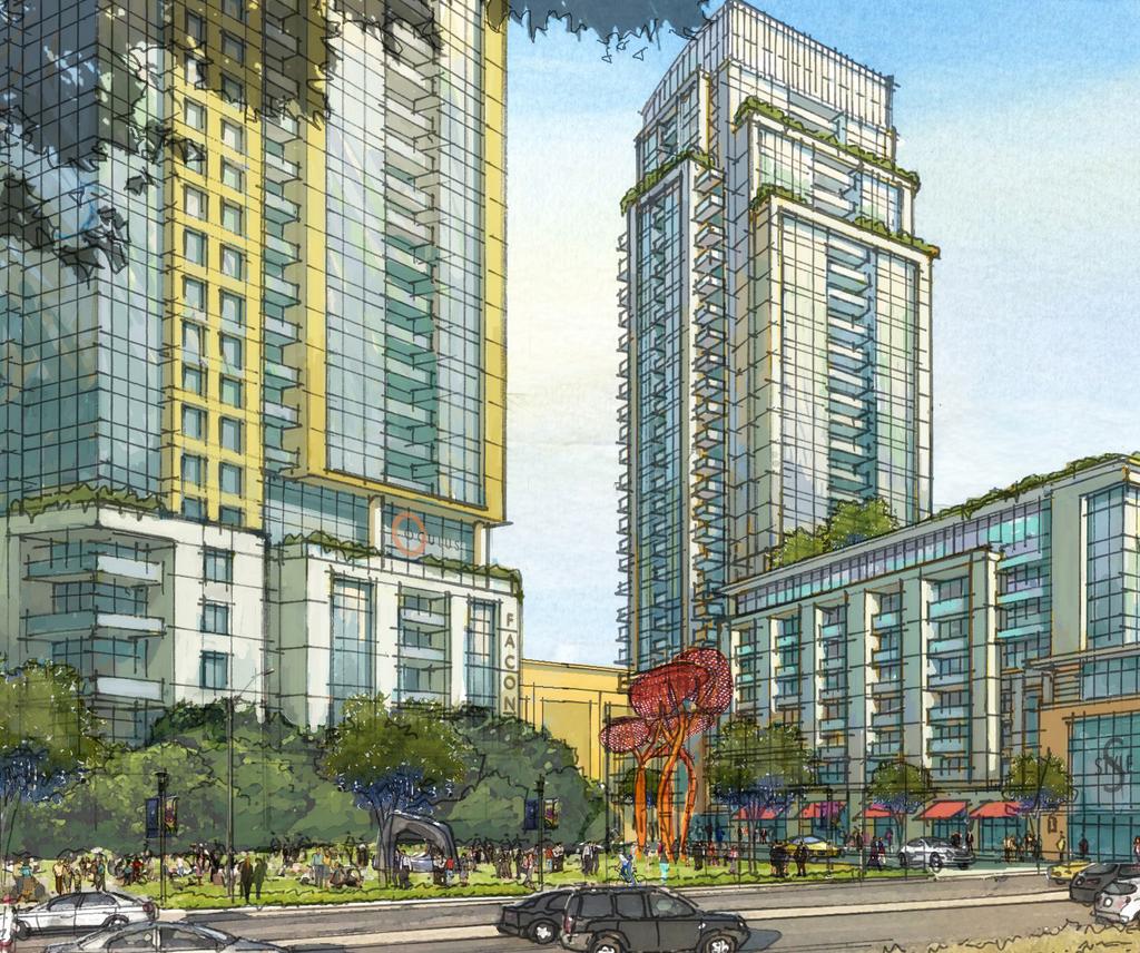
81
City of Kingston Report to Committee of Adjustment Report Number COA
 To: From: Date of Meeting: Application for: File Number: Address: Owner: Applicant: City of Kingston Chair and Members of Committee of Adjustment Sajid Sifat, Intermediate Planner Minor Variance D13-032-2018
TRANSPORTATION COMMITTEE
 Meeting 2007 October 15 COUNCIL REPORT TRANSPORTATION COMMITTEE HIS WORSHIP, THE MAYOR AND COUNCILLORS SUBJECT: METROTOWN TRANSIT VILLAGE STUDY RECOMMENDATIONS: 1. THAT Council approve in principle the
Scheme MOT Facility Improvements
 Scheme Houston Zoo McGovern Lake Reflection Pool 9 The Lake Plaza 0 8 Hermann Park Golf Course 0 00 00 00 Legend. MOT Facility Improvements. MOT Concession Area. VIP Suites. Expanded Theatre Seating. Parking
Major department stores anchoring Hillsdale Shopping Center are Macy s and Nordstrom.
 PA 14-103 Hillsdale Shopping Center North Block Redevelopment Preliminary Application Meeting notes from Neighborhood Meeting held 1/12/15 SPEAKERS: Tricia Schimpp, Project Planner, City of San Mateo Ms.
SECTION 5900 TRAFFIC SIGNALS CITY OF LEE S SUMMIT, MISSOURI DESIGN CRITERIA
 SECTION 5900 TRAFFIC SIGNALS CITY OF LEE S SUMMIT, MISSOURI DESIGN CRITERIA TABLE OF CONTENTS Section Title Page 5901 GENERAL... 2 5902 DESIGN CRITERIA... 2 5902.1 Codes and Standards... 2 5902.2 Signal
Welcome SIGN CODE UPDATE
 Welcome SIGN CODE UPDATE PUBLIC MEETING Aztlan Community Center Thursday, May 24, 2018 Community Room 5:30 7:30 PM 112 E Willow Street, Fort Collins *Brief orientation at 6:00 PM* PROCESS AND HOW TO PARTICIPATE
Planning & Zoning Commission Meeting Date: June 18, 2012
 Department of Planning and Research City of League City Planning & Zoning Commission Meeting Date: June 18, 2012 Requests Zoning Change Z12-04 (Lucas Construction) Rezone approximately 0.92 acres from
Environmental Impact Statement (EIS)/ Section 106 Public Meeting Level 1 Concept Screening. May 16, 2017
/ Section 106 Public Meeting Level 1 Concept Screening. May 16, 2017") Environmental Impact Statement (EIS)/ Section 106 Public Meeting Level 1 Concept Screening May 16, 2017 Today s Agenda Project Overview Project Schedule Purpose and Need Level 1 Concept Screening Results
Environmental Impact Statement (EIS)/ Section 106 Public Meeting Level 1 Concept Screening May 16, 2017 Today s Agenda Project Overview Project Schedule Purpose and Need Level 1 Concept Screening Results
City Council Report 915 I Street, 1 st Floor
 Meeting Date: 8/4/2016 Report Type: Consent Report ID: 2016-00700 03 City Council Report 915 I Street, 1 st Floor www.cityofsacramento.org Title: Ordinance adding Sections 15.148.015 and 15.148.191 to
In the proposed amendment below, text shown with underline is proposed to be added and text shown with strikethrough is proposed to be removed.
 ZOA-13-07 AN ORDINANCE TO AMEND, REENACT AND RECODIFY ARTICLES 13 AND 18 OF THE ARLINGTON COUNTY ZONING ORDINANCE TO DEFINE LARGE MEDIA SCREENS AS AUTOMATIC CHANGEABLE COPY SIGNS LARGER THAN 12 SQUARE
Urban Design Program. University of Calgary. Metrotown: Regional Town Centre. Metrotown
 University of Calgary Urban Design Program Metrotown October 12, 2004 Metrotown: Before we head out on our walking tour I thought it would be useful to give you a quick overview of Metrotown. Metrotown
Section 1. Appendix A, "Zoning" of the Code of the City of Charlotte is hereby amended as follows:
 Revised 7-18-11 Petition No. 2011-047 Petitioner: Neighborhood & Business Services ORDINANCE NO. AN ORDINANCE AMENDING APPENDIX A OF THE CITY CODE ZONING ORDINANCE BE IT ORDAINED BY THE CITY COUNCIL OF
REPORT TO THE PLANNING COMMISSION
 REPORT TO THE PLANNING COMMISSION Meeting Date: May 13, 2015 Application: Design Review PDR15-0006 Location / APN: Near 19700 Prospect Road / 386-35-070 Owner / Applicant: Staff Planner: City of Saratoga
Alberta Electric System Operator
 Decision 21038-D01-2016 Downtown Calgary 138-kV Transmission System Reinforcement June 1, 2016 Alberta Utilities Commission Decision 21038-D01-2016 Downtown Calgary 138-kV Transmission System Reinforcement
THE CITY OF WINNIPEG BY-LAW NO. 36/2013
 THE CITY OF WINNIPEG BY-LAW NO. 36/2013 A By-law of The City of Winnipeg to amend Winnipeg Zoning By-law No. 200/2006 with respect to digital signs and billboards. THE CITY OF WINNIPEG, in Council assembled,
ELIGIBLE INTERMITTENT RESOURCES PROTOCOL
 FIRST REPLACEMENT VOLUME NO. I Original Sheet No. 848 ELIGIBLE INTERMITTENT RESOURCES PROTOCOL FIRST REPLACEMENT VOLUME NO. I Original Sheet No. 850 ELIGIBLE INTERMITTENT RESOURCES PROTOCOL Table of Contents
Minutes of the Planning Board of the Township Of Hanover JULY 28, Board Secretary, Kimberly Bongiorno took the Roll Call.
 Page 1 of 7 Minutes of the Planning Board of the Township Of Hanover Chairman Robert Nardone called the Work Session Meeting to order at 7:07PM in Conference Room A and The Open Public Meetings Act Statement
For an Outdoor Kiosk Licence
 APPLICATION For an Outdoor Kiosk Licence Within City Square Hastings City Centre Trim Ref: REG-35-18-225 Issue: 10 / Date: 3 July 2018 Page 1 of 12 What is an outdoor kiosk licence? An Outdoor Kiosk Licence
City of Charlottesville Bicycle and Pedestrian Master Plan Update
 City of Charlottesville Bicycle and Pedestrian Master Plan Update April 3, 2014 CHARLOTTESVILLE BICYCLE/PEDESTRIAN MASTER PLAN UPDATE Welcome and Introductions Project Overview / Presentation Discussion
Questions and Comments to Discuss with Staff
 Questions and Comments to Discuss with Staff Specific Items in the Draft Revised Noise Code Page 12 1. Noting the definition that Impulsive noise means noise characterized by brief bursts (usually less
PUBLIC CONSULTATION ON THE QUARTIER DES GARES ONLINE QUESTIONNAIRE. Hello!
 PUBLIC CONSULTATION ON THE QUARTIER DES GARES ONLINE QUESTIONNAIRE Hello! The Office de consultation publique de Montréal (OCPM) is currently holding a consultation on the future of the Quartier des gares.
Licensing & Regulation #379
 Licensing & Regulation #379 By Anita Gallucci I t is about three years before your local cable operator's franchise is to expire and your community, as the franchising authority, receives a letter from
Tower Regulations in Calgary (Amateur Radio Services)
") Tower Regulations in Calgary (Amateur Radio Services) An update for 2016 by Tim Ellam VE6SH April 16, 2016 Do you really need one? What are your interests? Present station location Present circumstances
Tower Regulations in Calgary (Amateur Radio Services) An update for 2016 by Tim Ellam VE6SH April 16, 2016 Do you really need one? What are your interests? Present station location Present circumstances
SIDRA INTERSECTION 8.0 UPDATE HISTORY
 Akcelik & Associates Pty Ltd PO Box 1075G, Greythorn, Vic 3104 AUSTRALIA ABN 79 088 889 687 For all technical support, sales support and general enquiries: support.sidrasolutions.com SIDRA INTERSECTION
Policy on the syndication of BBC on-demand content
 Policy on the syndication of BBC on-demand content Syndication of BBC on-demand content Purpose 1. This policy is intended to provide third parties, the BBC Executive (hereafter, the Executive) and licence
47 USC 534. NB: This unofficial compilation of the U.S. Code is current as of Jan. 4, 2012 (see
 TITLE 47 - TELEGRAPHS, TELEPHONES, AND RADIOTELEGRAPHS CHAPTER 5 - WIRE OR RADIO COMMUNICATION SUBCHAPTER V-A - CABLE COMMUNICATIONS Part II - Use of Cable Channels and Cable Ownership Restrictions 534.
one bloor firstgulf.com FIRST GULF CONTACT: Jonathan Weinberg T:
 FIRST GULF CONTACT: Jonathan Weinberg T: 416.773.7067 one bloor firstgulf.com 3751 Victoria Park Avenue, Toronto, Ontario T: 416.491.7778 F: 416.491.1351 VIEW FROM YONGE & BLOOR welcome to one bloor Over
S E - 2, S T H
 / B STREET restaurant space for lease - 2,814 SF - 27 TH & CAPITOL, SACRAMENTO, CA 95816 /midtown's new cultural epicenter Turton Commercial Real Estate, as exclusive advisor for the B Street Theatre,
APPLICATION AND EFFECTIVENESS OF THE SEA DIRECTIVE (DIRECTIVE 2001/42/EC) 1. Legal framework CZECH REPUBLIC LEGAL AND ORGANISATIONAL ARRANGEMENTS 1
 1. Legal framework CZECH REPUBLIC LEGAL AND ORGANISATIONAL ARRANGEMENTS 1") APPLICATION AND EFFECTIVENESS OF THE SEA DIRECTIVE (DIRECTIVE 2001/42/EC) CZECH REPUBLIC LEGAL AND ORGANISATIONAL ARRANGEMENTS 1 This summary provides basic information on the legal, administrative and
APPLICATION AND EFFECTIVENESS OF THE SEA DIRECTIVE (DIRECTIVE 2001/42/EC) CZECH REPUBLIC LEGAL AND ORGANISATIONAL ARRANGEMENTS 1 This summary provides basic information on the legal, administrative and
T H E V I L L A G E M A R K E T
 MARKET DISCOVER The Village welcomes you for an unparalleled experience. When searching for a site to hold events, the key things planners tend to look for are Location, Space and Service. These are not
Preliminary Transportation Recommendations for. Presentation to Sector Plan Work Group/WRAC October 5, 2009
 Preliminary Transportation Recommendations for the Wheaton Sector Plan Presentation to Sector Plan Work Group/WRAC October 5, 2009 WheatonPresentation Topics Where we are: Opportunities for improvement,
IMPLEMENTATION OF SIGNAL SPACING STANDARDS
 IMPLEMENTATION OF SIGNAL SPACING STANDARDS J D SAMPSON Jeffares & Green Inc., P O Box 1109, Sunninghill, 2157 INTRODUCTION Mobility, defined here as the ease at which traffic can move at relatively high
FIVE FLAGS CENTER FEASIBILITY STUDY REPORT
 FIVE FLAGS CENTER FEASIBILITY STUDY REPORT The FFCC has long-served as an important community asset for Dubuque and its residents. Its long history can be traced back to the mid-1800 with the opening of
one bloor firstgulf.com FIRST GULF CONTACT: Jonathan Weinberg Vice President, Retail T:
 FIRST GULF CONTACT: Jonathan Weinberg Vice President, Retail T: 416.773.7067 one bloor firstgulf.com 3751 Victoria Park Avenue, Toronto, Ontario T: 416.491.7778 F: 416.491.1351 VIEW FROM YONGE & BLOOR
Street Theater. New Broadway Theater Anchors New Downtown District GTS Development LLC September 20, 2017
 Street Theater New Broadway Theater Anchors New Downtown District Speakers Stephen L. Swisher, AIA LEED AP Lead Principal-GTS Development, LLC Justin Belliveau Former Chief Administrative Officer- Salt
NATIONAL ASSOCIATION OF BROADCASTERS SUBMISSION TO THE PARLIAMENTARY PORTFOLIO COMMITTEE ON SCIENCE AND TECHNOLOGY ON THE ASTRONOMY GEOGRAPHIC
 NATIONAL ASSOCIATION OF BROADCASTERS SUBMISSION TO THE PARLIAMENTARY PORTFOLIO COMMITTEE ON SCIENCE AND TECHNOLOGY ON THE ASTRONOMY GEOGRAPHIC ADVANTAGE BILL [B17-2007] 20 JULY 2007 1. INTRODUCTION 1.1
CPA Standard 014. Clearing Replacement Document Design Standard
 CANADIAN PAYMENTS ASSOCIATION ASSOCIATION CANADIENNE DES PAIEMENTS CPA Standard 014 Clearing Replacement Document Design Standard 2013 CANADIAN PAYMENTS ASSOCIATION 2013 ASSOCIATION CANADIENNE DES PAIEMENTS
Request for Proposals Fiber Optic Network Backbone Upgrades
 Introduction Request for Proposals Fiber Optic Network Backbone Upgrades RFP Released on February 18, 2015 The Dexter R-11 Public School District is seeking proposals from qualified service providers to
NEW APPROACHES IN TRAFFIC SURVEILLANCE USING VIDEO DETECTION
 - 93 - ABSTRACT NEW APPROACHES IN TRAFFIC SURVEILLANCE USING VIDEO DETECTION Janner C. ArtiBrain, Research- and Development Corporation Vienna, Austria ArtiBrain has installed numerous incident detection
Signal Sighting Standard
 Engineering Standard Signals L1-CHE-STD-004 Signal Sighting Standard Version: 1 Issued: June 2016 Owner: Engineering Approved By: Phil Ellingworth Chief Engineer PRINTOUT MAY NOT BE UP-TO-DATE; REFER TO
Network Safeworking Rules and Procedures
 Network Safeworking Rules and Procedures Fixed Signals Rule Number: 6005 Version 1.0, 31 March 2016 Fixed Signals Rule Number: 6005 Document Control Identification Document title Number Version Date 6005
Attachment 7: 5/9/13 Neighborhood Meeting Summary
 Attachment 7: 5/9/13 Neighborhood Meeting Summary PA 13-014 Hillsdale Shopping Center North Block Reconfiguration Pre-application Meeting notes from Neighborhood Meeting held 5/9/13 Discussion 1: Groceries,
STRAND ALDWYCH PROPOSALS
 STRAND ALDWYCH PROPOSALS SHARE YOUR VIEWS ON DRAFT DESIGN CONCEPTS FOR THE STRAND ALDWYCH AREA OPEN 0 JANUARY TO 1 MARCH 019 STRANDALDWYCH.ORG HAVE YOUR SAY THE CHALLENGES OUR OBJECTIVES INTRODUCTION As
ITU-T Y.4552/Y.2078 (02/2016) Application support models of the Internet of things
 Application support models of the Internet of things") I n t e r n a t i o n a l T e l e c o m m u n i c a t i o n U n i o n ITU-T TELECOMMUNICATION STANDARDIZATION SECTOR OF ITU Y.4552/Y.2078 (02/2016) SERIES Y: GLOBAL INFORMATION INFRASTRUCTURE, INTERNET
I n t e r n a t i o n a l T e l e c o m m u n i c a t i o n U n i o n ITU-T TELECOMMUNICATION STANDARDIZATION SECTOR OF ITU Y.4552/Y.2078 (02/2016) SERIES Y: GLOBAL INFORMATION INFRASTRUCTURE, INTERNET
The Telecommunications Act Chap. 47:31
 The Telecommunications Act Chap. 47:31 4 th September 2013 Presentation Overview Legislative Mandate Limitations of Telecommunications Act Proposed Amendments to Telecommunications Act New Technological
City Council Report 915 I Street, 1 st Floor
 Meeting Date: 4/14/2016 Report Type: Staff/Discussion Report ID: 2016-00333 12 City Council Report 915 I Street, 1 st Floor www.cityofsacramento.org Title: Ordinance Adding Section 15.148.920 to the Sacramento
Wolf Commercial Real Estate ADMIRAL WILSON SOUTH 17 TH & 19 TH STREETS I CAMDEN, NJ
 PREMIER CAMDEN NEW JERSEY DEVELOPMENT SITE AVAILABLE ADMIRAL WILSON BOULEVARD @ SOUTH 17 TH & 19 TH STREETS I CAMDEN, NJ www.wolfcre.com Property/Area Description Location Admiral Wilson Boulevard @ South
ARLINGTON COUNTY, VIRGINIA. County Board Agenda Item Meeting of January 23, 2016 SUPPLEMENTAL REPORT REVISED DRAWINGS AND AMENDED CONDITIONS
 ARLINGTON COUNTY, VIRGINIA County Board Agenda Item Meeting of January 23, 2016 SUPPLEMENTAL REPORT REVISED DRAWINGS AND AMENDED CONDITIONS DATE: January 20, 2016 SUBJECTS: A. GP-332-15-1 Request to amend
CROCODILE AUSTRIA VIDEOSYSTEM
 Project Reference: A3 Project Name: Videosystem ITS Corridor: CROCODILE Project Location: Western part of Austria 1. DESCRIPTION OF THE PROBLEM ADDRESSED BY THE PROJECT 1.1 Nature of the Site The Austrian
Block System Interface Requirements
 Block System Interface Requirements Synopsis This document mandates the requirements for block systems interfaces between signalling infrastructure and railway operations. Copyright in the s is owned by
General Purposes. Tariff GP ( ) Contents. Effective from 1st July 2016 (Also showing previous year s details in brackets)
 Contents. Effective from 1st July 2016 (Also showing previous year s details in brackets)") General Purposes Tariff GP (2016.07) Effective from 1st July 2016 (Also showing previous year s details in brackets) Contents 1. Scope of tariff 2. General conditions 3. Royalty rates 3.1 Featured music
General Purposes Tariff GP (2016.07) Effective from 1st July 2016 (Also showing previous year s details in brackets) Contents 1. Scope of tariff 2. General conditions 3. Royalty rates 3.1 Featured music
General Purposes Tariff GP ( ) Effective from 1st July 2015 (Also showing previous year s details in brackets)
 Effective from 1st July 2015 (Also showing previous year s details in brackets)") General Purposes Tariff GP (2015.07) Effective from 1st July 2015 (Also showing previous year s details in brackets) Contents 1. Scope of tariff 2. General conditions 3. Royalty rates 3.1 Featured music
General Purposes Tariff GP (2015.07) Effective from 1st July 2015 (Also showing previous year s details in brackets) Contents 1. Scope of tariff 2. General conditions 3. Royalty rates 3.1 Featured music
Metrotown Station and Exchange Upgrades
 Metrotown Station and Exchange Upgrades Welcome to the Metrotown Station and Exchange Upgrade Open House Purpose of the Open House: Inform neighbours, businesses and customers about: the conceptual design
ORGANIC REGENERATION OF THE HISTORIC DOWNTOWN OF SHANTOU
 ORGANIC REGENERATION OF THE HISTORIC DOWNTOWN OF SHANTOU UPAT Shantou 9th - 15th March 2013 ISOCARP UPAT 9-15TH MARCH 2013 1 The Team - 9 Professionals from 8 Countries UPAT Shantou, 9th - 15th March 2013
SUMMARY REPORT. Consultation Summary Report. January 2016
 SUMMARY REPORT BC Hydro Public Consultation: Transmission Line Relocation George Massey Tunnel November 2 20, 2015 Consultation Summary Report January 2016 Prepared by Kirk & Co. Consulting Ltd. About
ITU-T Y Functional framework and capabilities of the Internet of things
 I n t e r n a t i o n a l T e l e c o m m u n i c a t i o n U n i o n ITU-T Y.2068 TELECOMMUNICATION STANDARDIZATION SECTOR OF ITU (03/2015) SERIES Y: GLOBAL INFORMATION INFRASTRUCTURE, INTERNET PROTOCOL
Australian Broadcasting Corporation. Department of Broadband, Communications and the Digital Economy
 Australian Broadcasting Corporation submission to Department of Broadband, Communications and the Digital Economy Response to the Discussion Paper Content and access: The future of program standards and
RENEWAL OF PREVIOUSLY APPROVED OUTDOOR MARKETING GRAPHIC DISPLAY PERMIT FEE: $25.00
 Borough of Haddonfield Outdoor Marketing Graphic Display Permit PLEASE COMPLETE ENTIRE PACKET Insurance form is required for all permit applications! An application is required PRIOR to displaying an Outdoor
Taubman Centers, Inc. Beverly Center Los Angeles, Calif. March 7, 2016
 Taubman Centers, Inc. Beverly Center Los Angeles, Calif. March 7, 2016 Introduction History Beverly Center opened on March 31, 1982 The center becomes an iconic asset and LA s premier shopping destination
Broadcasting Order CRTC
 Broadcasting Order CRTC 2012-409 PDF version Route reference: 2011-805 Additional references: 2011-601, 2011-601-1 and 2011-805-1 Ottawa, 26 July 2012 Amendments to the Exemption order for new media broadcasting
ARTICLE 8 - SIGN REGULATIONS
 ARTICLE 8 - SIGN REGULATIONS These regulations are intended to apply to all zoning districts. However, these regulations may not be pertinent to all uses and situations. 8.1 DEFINITIONS ABANDONED SIGN
Chairman Rolfsen called the Public Hearing to order at 7:37 P.M. and introduced the first item on the Agenda:
 BOONE COUNTY PLANNING COMMISSION BOONE COUNTY ADMINISTRATION BUILDING BOONE COUNTY FISCAL COURTROOM PUBLIC HEARINGS AUGUST 3, 2016 7:30 P.M. COMMISSION MEMBERS PRESENT: Mr. Matt Apke Mr. Randy Bessler
BRAND GUIDELINES. DavidMason.com or CHICAGO SAINT LOUIS CENTER CITY NORRISTOWN
 BRAND GUIDELINES DavidMason.com or Info@DavidMason.com SAINT LOUIS CHICAGO CENTER CITY NORRISTOWN 800 South Vandeventer Ave. St. Louis, Missouri 63110 Phone: 314.534.1030 Fax: 314.534.1053 464 North Milwaukee
OFFICE LEASING OPPORTUNITIES
 OFFICE LEASING OPPORTUNITIES THE BUILDING Marine Gateway is a premier, mixed-use community fully integrated with the Canada Line and the South Vancouver Bus Loop. The LEED Gold A class office space comprises
TV Character Generator
 TV Character Generator TV CHARACTER GENERATOR There are many ways to show the results of a microcontroller process in a visual manner, ranging from very simple and cheap, such as lighting an LED, to much
SHALER TOWNSHIP PLANNING COMMISSION April 18, 2016
 SHALER TOWNSHIP PLANNING COMMISSION April 18, 2016 The Regular Meeting of the Shaler Township Planning Commission was held on April 18, 2016, at 7:30 p.m. Mr. Piekarski called the meeting to order. Ms.
Appendix II Decisions on Recommendations Matrix for First Consultation Round
 Appendix II Decisions on Recommendations Matrix for First Consultation Round The following summarises the comments and recommendations received from stakehols on the Consultative Document on Broadcasting
ANNEXURE 3 KARANGAHAPE ROAD DESIGN GUIDELINES
 ANNEXURE 3 KARANGAHAPE ROAD DESIGN GUIDELINES CENTRAL AREA SECTION - OPERATIVE 2004 Page 1 Page 2 CENTRAL AREA SECTION - OPERATIVE 2004 CONTENTS PREFACE...4 HISTORY AND DEVELOPMENT PATTERNS...5 ARCHITECTURAL
21 December Mr. Michael Helm Director General Telecommunications Policy Branch Industry Canada 300 Slater Street Ottawa, Ontario, K1A 0C8
 21 December 2001 Don Woodford Director - Government & Regulatory Affairs Mr. Michael Helm Director General Telecommunications Policy Branch Industry Canada 300 Slater Street Ottawa, Ontario, K1A 0C8 Dear
Impact Of Multiplexes On Urban Traffic PLANNING THESIS IMPACT OF MULTIPLEXES ON URBAN TRAFFIC. (Case study on IMAX AND PVR)
") PLANNING THESIS IMPACT OF MULTIPLEXES ON URBAN TRAFFIC (Case study on IMAX AND PVR) By Sandeep reddy.t.r, Roll No: 070220, B.Tech (Plg), 8 th Semester. Under the Supervision of Mr.Revapathi DEPARTMENT
PLANNING THESIS IMPACT OF MULTIPLEXES ON URBAN TRAFFIC (Case study on IMAX AND PVR) By Sandeep reddy.t.r, Roll No: 070220, B.Tech (Plg), 8 th Semester. Under the Supervision of Mr.Revapathi DEPARTMENT
Before the FEDERAL COMMUNICATIONS COMMISSION Washington DC ) ) ) ) ) ) ) ) COMMENTS OF
 ) ) ) ) ) ) ) COMMENTS OF") Before the FEDERAL COMMUNICATIONS COMMISSION Washington DC 20554 In the Matter of Amendment of Part 101 of the Commission s Rules to Facilitate the Use of Microwave for Wireless Backhaul and Other Uses
Before the FEDERAL COMMUNICATIONS COMMISSION Washington DC 20554 In the Matter of Amendment of Part 101 of the Commission s Rules to Facilitate the Use of Microwave for Wireless Backhaul and Other Uses
SOUTHWESTERN BELL TELEPHONE COMPANY TARIFF F.C.C. NO. 73 1st Revised Page 9-1 Cancels Original Page 9-1
 1st Revised Page 9-1 Cancels Original Page 9-1 9. Directory Assistance Access Service 9-2 9.1 General Description 9-2 9.2 Service Description 9-3 9.3 Service Provisioning 9-4 Page 9.3.1 Manner of Provisioning
Arrangements for: National Progression Award in. Music Business (SCQF level 6) Group Award Code: G9KN 46. Validation date: November 2009
 Group Award Code: G9KN 46. Validation date: November 2009") Arrangements for: National Progression Award in Music Business (SCQF level 6) Group Award Code: G9KN 46 Validation date: November 2009 Date of original publication: January 2010 Version: 03 (August 2011)
Arrangements for: National Progression Award in Music Business (SCQF level 6) Group Award Code: G9KN 46 Validation date: November 2009 Date of original publication: January 2010 Version: 03 (August 2011)
>> By Jason R. Kack, LS
 hen the Utah Department of Transportation (UDOT) set out to rebuild Interstate 15 south of Salt Lake City, the department needed accurate one-foot contour interval mapping and a digital terrain model (DTM).
Roadway/Structure Widening Project MP A30.30 to MP A Lansdale Montgomery County, PA NOISE ANALYSIS REPORT FINAL. August 2006.
 Roadway/Structure Widening Project Lansdale Montgomery County, PA NOISE ANALYSIS REPORT Prepared for: Pennsylvania Turnpike Commission P.O. Box 67676 Harrisburg, PA 17106-7676 August 2006 FINAL EXECUTIVE
AltaLink Management Ltd.
 Decision 21317-D01-2016 Central Alberta Underground Fibre Optic Build July 12, 2016 Alberta Utilities Commission Decision 21317-D01-2016 Central Alberta Underground Fibre Optic Build Proceeding 21317 Application
graphic standards adopted May 2007
 graphic standards adopted May 2007 All Canadian made for all Canadian weather Gord Wiebe President & CEO Dear All Weather Windows Colleague, The All Weather Windows brand and product are valuable company
Introduction. Page 1. Welcome to the signage guidelines for St John Ambulance premises, updated as of May 2013.
 Signage guidelines Introduction Welcome to the signage guidelines for St John Ambulance premises, updated as of May 2013. These guidelines provide a signage standard for all St John Ambulance buildings,
First Floor Community Corridor
 Seattle Art Museum First Floor Community Corridor Guidelines and FAQ 1 What is the First Floor The Seattle Art Museum s First Floor Community Corridor is a free public space dedicated to community building
High Traffic Single Tenant Building with Outdoor Patio Ideal for Restaurant, Brewery, or Retail
 High Traffic Single Tenant Building with Outdoor Patio Ideal for Restaurant, Brewery, or Retail 1929 University Avenue Retail Space for Lease Size: +/- 4,100 rentable sq. ft. plus rear patio Lease Rate:
DESTINATION ABOUT EMAAR INTERIOR DESIGN PROJECT OVERVIEW LOCATION AMENITIES FLOOR PLANS CONTACT US
 03 04 ABOUT EMAAR DESTINATION 06 09 10 PROJECT OVERVIEW LOCATION INTERIOR DESIGN 14 17 36 AMENITIES FLOOR PLANS CONTACT US L O C A L D E V E L O P E R, G L O B A L REPUTATION Established in 1997, Emaar
OECD COMMUNICATIONS OUTLOOK 2001 Broadcasting Section
 OECD COMMUNICATIONS OUTLOOK 2001 Broadcasting Section Country: CANADA Date completed: June 29, 2000 1 Broadcasting services available BROADCASTING 1. Please provide details of the broadcasting and cable
Yorkdale Station Easier Access Project Public Open House
 Yorkdale Station Easier Access Project Public Open House 1 Easier access program wide Committed to making all stations accessible by 2025 37 stations completed to date Working with the Advisory Committee
6. Institutional Planning and Budgeting Processes
 6. Institutional Planning and Budgeting Processes 1702 1703 1704 1705 1706 1707 1708 1709 1710 1711 1712 1713 1714 1715 1716 1717 1718 1719 1720 1721 1722 1723 1724 1725 1726 1727 1728 1729 1730 1731 1732
The Lerbäck theatre barn conversion of an old barn into a theatre
 This series of informative fiches aim to present, in summary, examples of practices and approaches that EU Member States and Regions have put in place in order to implement their Rural Development Programmes
WIRELESS PLANNING MEMORANDUM
 WIRELESS PLANNING MEMORANDUM TO: Andrew Cohen-Cutler FROM: Robert C. May REVIEWER: Jonathan L. Kramer DATE: RE: Technical Review for Proposed Modification to Rooftop Wireless Site (File No. 160002523)
redbox INFORMATION PACK VERSION 1.0 solutions uk
 INFORMATION PACK VERSION 1.0 contents Overview... 01 Service Overview... 02 Managed Services... 03 Telecoms Services... 04 Photomontage samples Technical Illustration samples Security Services... 08 Access
Branding Guidelines NOTICE:
 Branding Guidelines NOTICE: THE STRUCTURE OF THE HEVC ADVANCE LICENSING PROGRAM, INCLUDING THE TERMS HEVC ADVANCE IS CURRENTLY AUTHORIZED TO OFFER IN ITS PATENT PORTFOLIO LICENSE AGREEMENT, ARE SUBJECT
Considerations in Updating Broadcast Regulations for the Digital Era
 Considerations in Updating Broadcast Regulations for the Digital Era By Koji Yoshihisa Economic & Industrial Research Group Broadcast television, the undisputed king of entertainment in the household,
DESIGN STANDARD FOR AUDIOVISUAL SYSTEMS
 DESIGN STANDARD FOR AUDIOVISUAL SYSTEMS General: Solano Community College (SCC) is intent on moving to 21 st century unified communications and data systems, consistent with industry standards and best
TO BE PUBLISHED IN THE GAZETTE OF INDIA, EXTRAORDINARY, PART III, SECTION 4 TELECOM REGULATORY AUTHORITY OF INDIA
 TO BE PUBLISHED IN THE GAZETTE OF INDIA, EXTRAORDINARY, PART III, SECTION 4 TELECOM REGULATORY AUTHORITY OF INDIA THE TELECOMMUNICATION (BROADCASTING AND CABLE SERVICES) INTERCONNECTION (DIGITAL ADDRESSABLE
4 UNIFIED SIGNAGE MANUAL
 4 UNIFIED SIGNAGE MANUAL Introduction In order to unify the HINO brand image, this manual establishes Unified Signage Design and Installation Standards as an important element. Unified Signage is the important
PART 6 - Central Office Services 1st Revised Sheet 1 SECTION 7 - Digital Transport Services Replacing Original Sheet 1
 PART 6 - Central Office Services 1st Revised Sheet 1 SECTION 7 - Digital Transport Services Replacing Original Sheet 1 Material now appears in Part 20, Section 6, Sheet 18. ATT TN KS-16-0028 Effective:
Building Your DLP Strategy & Process. Whitepaper
 Building Your DLP Strategy & Process Whitepaper Contents Introduction 3 DLP Planning: Organize Your Project for Success 3 DLP Planning: Clarify User Profiles 4 DLP Implementation: Phases of a Successful
Kourou Media Guide. All accreditation requests from journalists, photographers or other media technicians must be made in the following manner:
 Kourou Media Guide Introduction Journalists visiting the Spaceport will be provided the support of Arianespace whenever possible. Modern press room facilities have been developed at the Spaceport's technical
FAR Part 150 Noise Exposure Map Checklist
 FAR Part 150 Noise Exposure Map Checklist I. IDENTIFICATION AND SUBMISSION OF MAP DOCUMENT: Page Number A. Is this submittal appropriately identified as one of the following, submitted under FAR Part 150:
EXPERIENCE WARNER CENTER THE ULTIMATE WORK LIVE PLAY ENVIRONMENT
 EXPERIENCE WARNER CENTER THE ULTIMATE WORK LIVE PLAY ENVIRONMENT WORK Douglas Emmett offers the widest variety of Class-A office product in the Warner Center region with a portfolio consisting of 2.8 Million
TruePlate Structural Plate
 TruePlate Structural Plate Galvanized Steel and Aluminum Alloy Sizes, Shapes and Height of Cover Tables TrueNorthSteel.com info@truenorthsteel.com 866-82-511 TruePlate Structural Plate Many drainage and
DM Scheduling Architecture
 DM Scheduling Architecture Approved Version 1.0 19 Jul 2011 Open Mobile Alliance OMA-AD-DM-Scheduling-V1_0-20110719-A OMA-AD-DM-Scheduling-V1_0-20110719-A Page 2 (16) Use of this document is subject to
A Real Word Case Study E- Trap by Bag End Ovasen Studios, New York City
 21 March 2007 070315 - dk v5 - Ovasen Case Study Written by David Kotch Edited by John Storyk A Real Word Case Study E- Trap by Bag End Ovasen Studios, New York City 1. Overview - Description of Problem